
|
| Our subscribers' grade-level estimate for this page: 3rd - 4th |
 Outline Maps |
EnchantedLearning.com World Geography |
 Flags |
| Africa | Antarctica | Asia | Australia/Oceania | Central America/ Caribbean | Europe | Mideast | North America | South America | USA |
| A | B | C | D | E | F | G | H | I | J | K | L | M | N | O | P | Q | R | S | T | U | V | W | X | Y | Z |
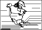
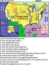
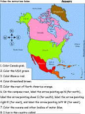 North America: Follow the Instructions Draw and color North America according to simple directions, such as, "Color the USA green." Or go to the answers. |
 North America: Map Quiz Printout Take a quiz on the map of North America. Or go to the answers. |
 North America: Label Me! Printout Label the countries of North America. Answers |
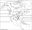
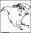 North America: Outline Map Printout An outline map of North America to print. |
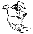 North America: Political Outline Map Printout A political outline map of North America to print (country lines marked). |
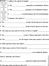 North America Quiz A Worksheet to Print A short, printable worksheet quiz about North America. The short-answer worksheet asks 15 general questions about North America, for example, "The capital of Canada is ______." Select the answers from a word bank. Or go to the answers. |
 North American Rivers Label Me Printout Label the major rivers of North America. Answers |
 North American Rivers: Outline Map Printout An outline map of the major rivers of North America to print. |
 Explorers of North America Traders, explorers, conquistadors, missionaries, and scientists who explored this continent. |
 Flags of North America |
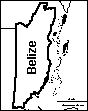 Belize: Outline Map Printout An outline map of Belize to print. |
 Canada: Geography, etc. Find information on Canada, including maps, flags, animals, explorers, fossils, art, quizzes, and books to print out. |
Canada: Geography Basic information on the geography of Canada. |
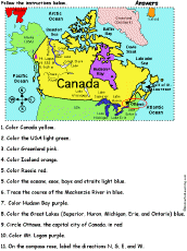 Canada: Follow the Instructions Color the Canada according to simple directions, such as, "Color Hudson Bay purple." Or go to the answers. |
 Canadian Provinces/Territories: Label Me! Printout Label Canada's 13 provinces and territories. |
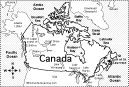
 Canada: Outline Map Printout An outline map of Canada to print. Or go to printable worksheets that require research (using an atlas or other geography reference): a simple map research activity, a medium-level map research activity, or an advanced map research activity. |
 Canada: Dot to Dot Mystery Map Connect the dots to draw the borders of a mystery country. Then use a globe or atlas to figure out which country you have drawn. You might want to give students clues, such as the continent the country is in (North America), that it is in the Northern Hemisphere, or that its name starts with "C." Answer: Canada. |
 Canada: Map Quiz Worksheet Answer questions about the map of Canada. |
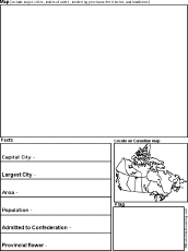 Canadian Province/Territory Report Graphic Organizer Printout #1 This printout helps the student do a short report on a Canadian Province/Territory, prompting the student to draw a map of the province, locate it on a world map, draw the province's flag, and write its capital city, largest city, area, population, date of admittance to confederation, and provincial flower. |
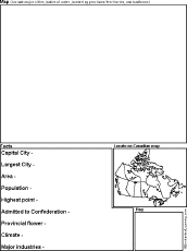 Canadian Province/Territory Report Graphic Organizer Printout #2 This printout helps the student do a short report on a Canadian Province/Territory, prompting the student to draw a map of the province, locate it on a world map, draw the province's flag, and write its capital city, largest city, area, population, highest point, date of admittance to confederation, provincial flower, climate, and major industries. |
Canada: Zoom School Use a pictorial interface to get information on Canada, including maps, animals, explorers, fossils, a quiz, and printouts on Canada. |
 Fact or Opinion? Canada Determine if the statements are facts or opinions. A fact is supported by evidence and can be proven; an opinion is how you feel about something and is open to debate. Or go to the answers. Or go to a pdf of the worksheet and answers (subscribers only). |
 Caribbean: Outline Map Printout An outline map of the Caribbean to print. |
 Central America: Label Me Printout Label the map of Central America. Answers |
Central America and the Caribbean Geography activities on Central America and the Caribbean. |
 Costa Rica: Outline Map Printout An outline map of Costa Rica to print. Or go to printable worksheets that require research (using an atlas or other geography reference): a simple map research activity, a medium-level map research activity, or an advanced map research activity. |
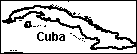 Cuba: Outline Map Printout An outline map of Cuba to print. |
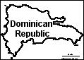 Dominican Republic: Outline Map Printout An outline map of the Dominican Republic to print. Or go to printable worksheets that require research (using an atlas or other geography reference): a simple map research activity, a medium-level map research activity, or an advanced map research activity. |
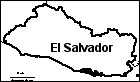 El Salvador: Outline Map Printout An outline map of El Salvador to print. |
 Great Lakes The Great Lakes are five huge, connected lakes located between Canada and the USA. The lakes are (from biggest to smallest) Lake Superior, Lake Michigan, Lake Huron, Lake Erie, and Lake Ontario. These lakes were formed by glaciers during the last Ice Age. |
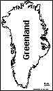 Greenland: Outline Map Printout An outline map of Greenland to print. |
 Guatemala: Outline Map Printout An outline map of Guatemala to print. Or go to printable worksheets that require research (using an atlas or other geography reference): a simple map research activity, a medium-level map research activity, or an advanced map research activity. |
 Haiti: Outline Map Printout An outline map of Haiti to print. Or go to printable worksheets that require research (using an atlas or other geography reference): a simple map research activity, a medium-level map research activity, or an advanced map research activity. |
 Honduras: Outline Map Printout An outline map of Honduras to print. Or go to printable worksheets that require research (using an atlas or other geography reference): a simple map research activity, a medium-level map research activity, or an advanced map research activity. |
Hurricane Tracking Quiz Test your knowledge of hurricane tracking, including tropical storm symbols, geography, latitude, and longitude. Or go to the answers. |
Hurricane Tracking Practice tracking a hurricane using this printout. Or go to the answers. |
Hurricane Tracking (Real Storm) Track a real hurricane using this printout. Get a hurricane's locations from the National Hurricane center. |
 Jamaica: Outline Map Printout An outline map of Jamaica to print. |
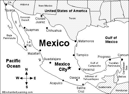
 Mexico, Geography Information on the geography of Mexico. |
 Mexico: Dot to Dot Mystery Map Connect the dots to draw the borders of a mystery country. Then use a globe or atlas to figure out which country you have drawn. You might want to give students clues, such as the continent the country is in (North America), that it is in the Northern Hemisphere, or that its name starts with "M." Answer: Mexico. |
 Mexico Map: Label Me! Printout Label a map of Mexico. Answers |
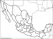
 Mexican States Map: Label Me! Printout Label the states of Mexico. Answers |
 Mexico: Map Quiz Worksheet A printable quiz on the major geographic features of Mexico. The student reads a map to answer 10 geography questions. Or go to the answers. |
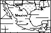
 Mexico: Outline Map Printout An outline map of Mexico to print. Or go to printable worksheets that require research (using an atlas or other geography reference): a simple map research activity, a medium-level map research activity, or an advanced map research activity. |
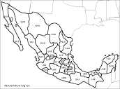
 Mexican States: Outline Map Printout An outline map of the states of Mexico to print. |
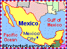 Mexico: Zoom School Use a pictorial interface to get Information on Mexico, incuding maps, flag, animals, explorers, fossils, a quiz, and printouts on Mexico. Mexico is a Spanish-speaking country in North America. Its capital is Mexico City. |
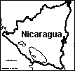 Nicaragua: Outline Map Printout An outline map of Nicaragua to print. |
 Panama: Label Me! Map Printout Label the map of Panama. Answers |
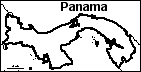 Panama: Outline Map Printout An outline map of Panama to print. Or go to printable worksheets that require research (using an atlas or other geography reference): a simple map research activity, a medium-level map research activity, or an advanced map research activity. |
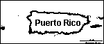 Puerto Rico: Outline Map Printout An outline map of Puerto Rico to print. |
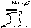 Trinidad and Tobago: Outline Map Printout An outline map of Trinidad and Tobago to print. |
 USA GEOGRAPHY PAGES Information, maps, printouts, quizzes, etc. |
 United States of America: Zoom School Use a pictorial interface to get information on the USA, including maps, flags, animals, explorers, fossils, a quiz, and printouts on the USA. The United States of America is a country in North America. There are 50 states in the United States of America. |
USA: Label Me! Printouts Label many maps of the USA. |
USA Map: Label the States Label the 50 US states on the map. Answers |
USA State Facts, Maps, and Symbols A page on each US state listing facts, map and symbols (each one with links to map and flag printouts/quizzes). |
 USA (no state borders): Outline Map Printout An outline map of the contiguous USA to print - no state boundaries marked. |
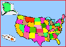
 USA (with state borders): Outline Map Printout An outline map of the contiguous USA to print - state boundaries marked. |
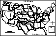
 USA (with state borders and states numbered): Outline Map Printout An outline map of the US states to print - state boundaries marked and the state are numbered (in order of statehood). You can use this map to have students list the 50 US states (answers), the state capitals (answers), or both states and capitals (answers). Or go to a printable page with 50 answer blanks (for your own questions), click here. |
 USA: Outline Map and Outline Map Research Worksheets An outline map of the United States of America to print. Or go to printable worksheets that require research (using an atlas or other geography reference): a simple map research activity, a medium-level map research activity, or an advanced map research activity. |
 United States of America: Follow the Instructions Color the USA according to simple directions, such as, "Draw orange stripes on the Rocky Mountains." Or go to the answers. |
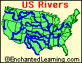 US Rivers A page on US rivers with a glossary of river terms. |
 US Rivers: Outline Map Printout An outline map of the contiguous USA with rivers marked - state boundaries also marked (printable). |
US Rivers Labeled: Outline Map Printout An outline map of the contiguous USA with rivers marked and labeled - state boundaries also marked (printable). |
US Regions: Map/Quiz Printouts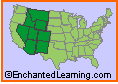 US Regional Map printouts: Read a map and answer questions about it. |
US State Flags: Coloring/Quiz Printouts Color US state flags and answer questions about them. |
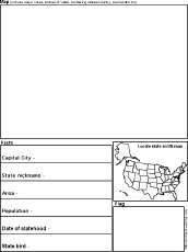 US State Report Graphic Organizer Printout #1 This printout helps the student do a short report on a US state, prompting the student to draw a map of the state, locate it on a US map, draw the state's flag, and write its capital city, state nickname, area, population, date of statehood, and state bird. |
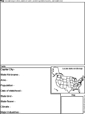 US State Report Graphic Organizer Printout #2 This printout helps the student do a short report on a US state, prompting the student to draw a map of the state, locate it on a US map, draw the state's flag, and write its capital city, state nickname, area, population, date of statehood, state bird, state flower, climate, and major industries. |
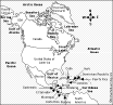
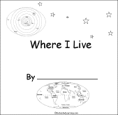 Where I Live (USA and Canada) A short activity book on geography to print for early readers. There are pages on the Solar System, the continents, North America, and Canada or the USA. |
USA: Shape Poem 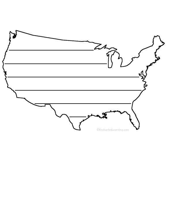 Write a poem inside the map of the USA. Or go to a pdf of the poem worksheet. |
 USA: Dot to Dot Mystery Map Connect the dots to draw the borders of a mystery country. Then use a globe or atlas to figure out which country you have drawn. You might want to give students clues, such as the continent the country is in (North America), that it is in the Northern Hemisphere, or that its name starts with "U." Answer: United States of America. |
Little Explorers Picture Dictionary:
-English
-English-French
-English-German
-English-Italian
-English-Portuguese
-English-Spanish
Enchanted Learning®
Over 35,000 Web Pages
Sample Pages for Prospective Subscribers, or click below
|
Overview of Site What's New Enchanted Learning Home Monthly Activity Calendar Books to Print Site Index K-3 Crafts K-3 Themes Little Explorers Picture dictionary PreK/K Activities Rebus Rhymes Stories Writing Cloze Activities Essay Topics Newspaper Writing Activities Parts of Speech Fiction The Test of Time
|
Biology Animal Printouts Biology Label Printouts Biomes Birds Butterflies Dinosaurs Food Chain Human Anatomy Mammals Plants Rainforests Sharks Whales Physical Sciences: K-12 Astronomy The Earth Geology Hurricanes Landforms Oceans Tsunami Volcano |
Languages Dutch French German Italian Japanese (Romaji) Portuguese Spanish Swedish Geography/History Explorers Flags Geography Inventors US History Other Topics Art and Artists Calendars College Finder Crafts Graphic Organizers Label Me! Printouts Math Music Word Wheels |
Click to read our Privacy Policy
| Search the Enchanted Learning website for: |
Copyright ©2002-2018 EnchantedLearning.com ------ How to cite a web page