
|
| You might also like: | Mali's Flag | Outline Map: Mali | Label the Map of Mali Printout | Somalia | Madagascar | Today's featured page: Piggy Bank Coins - Printable Book |
| Our subscribers' grade-level estimate for this page: 3rd - 4th |
Size: Mali covers an area of 1,240,000 sq km (almost twice the size of the US state of Texas).
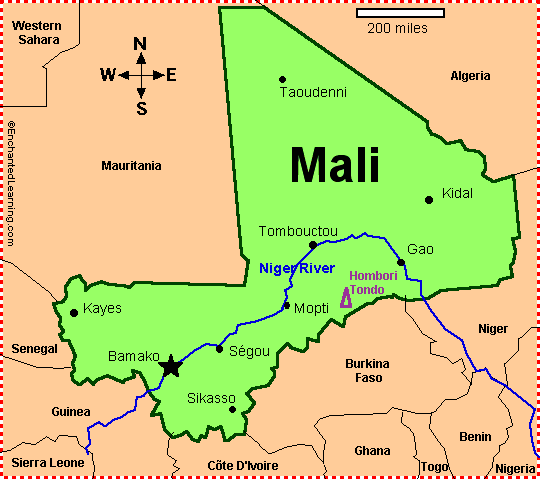
Capital: Bamako is the capital of Mali and the largest city in Mali.
Timbuktu: The legendary city of Timbuktu (Tombouctou) is located in central Mali, at the edge of the Sahara Desert. During the Middle Ages, Timbuktu was a very important city in the trade route; gold and other goods were shipped from Africa to Europe and the Middle East and traded for salt. It was also a major Islamic center (non-Muslims were banned from the city). Later, when trade routes shifted, Timbuktu was known as the a city in the middle of nowhere.

Outline Map of Mali
Label a map of MaliEnchantedLearning.com
Mali
Mali's Flag
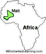 Location: Mali is a dry, inland country in western Africa.
Major Languages: French (the official language), Bambara, Senufu, Fulani, Soninke, and others.
Tribes/Ethnic Groups: Mali is the home of many tribes, including the Mande (which includes the Bambara, Dialonke, Dyula, Malinke, Mandinka, Mende, Soninke, and Susu), Fulani (also called the Peul, nomadic cattle herders), Voltaic, Songhay, Tuareg, Moor, Tuareg (often called the blue people of the desert, because the dye from their clothing rubs off on their skin), and Dogon (farmers).
Flag: The Malian flag is a green, yellow and red vertical tricolor (the green stripe is by the flagpole).
Independence and Democracy: The Sudanese Republic (now called Mali) and Senegal (which together had made up the French Sudan, a French territory) became independent from France in 1960. The Sudanese Republic and Senegal separated within a few months of their independence from France, and the Sudanese Republic was renamed the Republic of Mali. (The country currently called Sudan is a completely different country in sub-Saharan Africa that has a similar name.)
Mali's constitution was adopted on January 12, 1992. A dictatorship had ruled Mali for years since independence; the first democratic elections were held in 1992. Later, ethnic battles tore Mali apart, but a peace agreement was adopted in 1995. Mali is one of the poorest countries in the world.
National Holiday: Mali's Independence Day is celebrated on September 22 (Mali achieved independence from France in 1960).
Climate: Mali generally has a warm (subtropical), dry climate. About half of Mali is in the Sahara Desert (and the desert is expanding each year). Only 2 to 4 percent of Mali is arable (capable of producing farm crops).
Natural Resources: Mali has gold, phosphates, kaolin, salt, limestone, uranium, and hydropower (water-powered electricity). Most of the people in Mali (about 70-80 percent) make their living by farming and fishing; about 10 percent of the Malian population is nomadic.
Major Rivers: The major river in Mali is the Niger River; it provides Mali with water, fish, and transportation. The Senegal River separates Mali from Senegal.
Highest Point: The highest point in Mali is Hombori Tondo, which is 1,155 m (3,789 feet) above sea level.
Lowest Point: The lowest point in Mali is the Senegal River (along the southwestern border of Mali), which is 23 m above sea level.
Surrounding Countries: Senegal, Algeria, Niger, Guinea, Burkina Faso, Côte d'Ivoire, and Mauritania.
 Mali's Flag |
Mali: Outline Map Printout An outline map of Mali to print. |
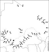 Mali: Dot to Dot Mystery Map Connect the dots to draw the borders of a mystery country. Then use a globe or atlas to figure out which country you have drawn. You might want to give students clues, such as the continent the country is in (Africa), that it is an island, or that its name starts with "M." Answer: Mali. |
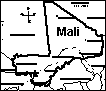 Mali Label a map of Mali. Answers |
 Africa: Zoom School Use a pictorial interface to get information on Africa. including maps, quizzes, animals, explorers, and printouts on Africa. |
 African Countries: Label Me! Printout Label the countries of Africa. Answers |
Africa: Label Me! Printout with First Letter Hints Label the countries and bodies of water of Africa, given the first letter of the places. Answers |
Enchanted Learning®
Over 35,000 Web Pages
Sample Pages for Prospective Subscribers, or click below
|
Overview of Site What's New Enchanted Learning Home Monthly Activity Calendar Books to Print Site Index K-3 Crafts K-3 Themes Little Explorers Picture dictionary PreK/K Activities Rebus Rhymes Stories Writing Cloze Activities Essay Topics Newspaper Writing Activities Parts of Speech Fiction The Test of Time
|
Biology Animal Printouts Biology Label Printouts Biomes Birds Butterflies Dinosaurs Food Chain Human Anatomy Mammals Plants Rainforests Sharks Whales Physical Sciences: K-12 Astronomy The Earth Geology Hurricanes Landforms Oceans Tsunami Volcano |
Languages Dutch French German Italian Japanese (Romaji) Portuguese Spanish Swedish Geography/History Explorers Flags Geography Inventors US History Other Topics Art and Artists Calendars College Finder Crafts Graphic Organizers Label Me! Printouts Math Music Word Wheels |
Click to read our Privacy Policy
| Search the Enchanted Learning website for: |