
|
Go back to the map quiz
More Geography Quizzes
Flag of GreeceEnchantedLearning.com
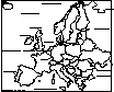
Map of Greece: Quiz Answers
Maps
Flags
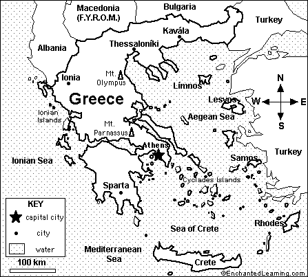
2. What is the name of the large sea that borders Greece on the south? Mediterranean Sea
3. What is the name of the sea that separates Greece from Turkey? Aegean Sea
4. What is the name of the long Greek island south of the mainland? Crete
5. What is the name of the country that borders Greece on the northwest (on the Ionian Sea)? Albania
6. The highest mountain in Greece is in northern Greece, east of Ionia. What is its name? Mt. Olympus
7. Is Sparta in the northern, southern, eastern, or western part of Greece? southern
8. If you wanted to travel from Crete to Rhodes, in which direction would you sail? northeast
9. If you wanted to travel from Athens to Mt. Parnassus, in which direction would you head? northwest
10. Roughly how many miles is it from Athens to Mt. Parnassus: 1 km, 10 km, 100 km, 1,000 km, or 10,000 km? 100 km
Related Pages:
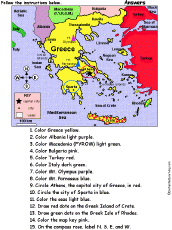 Greece: Follow the Instructions Color Greece according to simple directions, such as, "Draw a red circle around Athens, the capital city of Greece." Or go to the answers. |
 Greece: Flag Quiz/ Printout Answer questions and color the flag |
 Greece Geography, maps, the flag, and printouts on Greece. |
Greece: Map Coloring Printout Print and color the map of Greece |
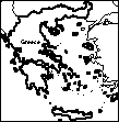 Greece: Outline Map Printout An outline map of Greece to print. |
 Europe Label the countries and bodies of water of Europe. Answers |
Europe: Label Me! Printout with First Letter Hints Label the countries and bodies of water of Europe, given the first letter of the places. Answers |
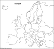 Europe: Outline Map Printout An outline map of Europe to print. |
Enchanted Learning®
Over 35,000 Web Pages
Sample Pages for Prospective Subscribers, or click below
|
Overview of Site What's New Enchanted Learning Home Monthly Activity Calendar Books to Print Site Index K-3 Crafts K-3 Themes Little Explorers Picture dictionary PreK/K Activities Rebus Rhymes Stories Writing Cloze Activities Essay Topics Newspaper Writing Activities Parts of Speech Fiction The Test of Time
|
Biology Animal Printouts Biology Label Printouts Biomes Birds Butterflies Dinosaurs Food Chain Human Anatomy Mammals Plants Rainforests Sharks Whales Physical Sciences: K-12 Astronomy The Earth Geology Hurricanes Landforms Oceans Tsunami Volcano |
Languages Dutch French German Italian Japanese (Romaji) Portuguese Spanish Swedish Geography/History Explorers Flags Geography Inventors US History Other Topics Art and Artists Calendars College Finder Crafts Graphic Organizers Label Me! Printouts Math Music Word Wheels |
Click to read our Privacy Policy
| Search the Enchanted Learning website for: |