
|
| You might also like: | Haiti's Flag Quiz/Printout | Flag of Haiti Printout | Flag of Saint Lucia Printout | Outline Map: Haiti | Flag of Bangladesh Printout | Today's featured page: White House |
| Our subscribers' grade-level estimate for this page: 1st - 2nd |
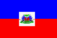
The Haitian flag is a red and blue bicolor; for state occasions, the Arms of Haiti are added to the center of the flag on a white background. The colors red and blue were chosen from the French flag. The Haitian arms depict a royal palm in the center topped with a red and blue cap of liberty. There are also six blue and red flags, two smaller red banners on the sides, many weapons (rifles with bayonettes, two yellow cannons and many cannonballs), a drum, an anchor, green grass, and a white banner reading "L'UNION FAIT LA FORCE," meaning "Union is Strength."
Haiti is located in the Caribbean Sea. Christopher Columbus sailed to Hispaniola in 1492. Haiti and the Dominican Republic constitute the island of Hispaniola, located east of Cuba; Haiti occupies the western third of the island. Haiti's capital city is Port-au-Prince.
Enchanted Learning®
Click to read our Privacy Policy
Haiti's Flag Printout/Quiz
Quiz AnswersEnchantedLearning.com
The Flag of Haiti
Maps
Flags
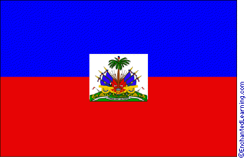 The flag of the Republic of Haiti was adopted on May 18, 1803. Haiti had been a colony of France since 1697, but the people rebelled in 1803 and Haiti achieved independence on January 1, 1804.
Related Pages:
Haiti: Flag Quiz/ Printout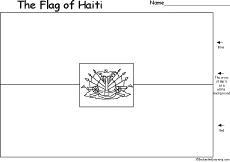
Flag of Haiti
Go to a blackline master (black-and-white printout) of the flag of Haiti.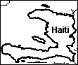
Haiti: Outline Map Printout
An outline map of Haiti to print. Or go to printable worksheets that require research (using an atlas or other geography reference): a simple map research activity, a medium-level map research activity, or an advanced map research activity.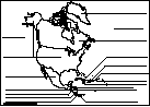
North America Printout: Label Me!
Label the countries of North America.
Answers
Over 35,000 Web Pages
Sample Pages for Prospective Subscribers, or click below
Overview of Site
What's New
Enchanted Learning Home
Monthly Activity Calendar
Books to Print
Site Index
K-3
Crafts
K-3 Themes
Little Explorers
Picture dictionary
PreK/K Activities
Rebus Rhymes
Stories
Writing
Cloze Activities
Essay Topics
Newspaper
Writing Activities
Parts of Speech
Fiction
The Test of Time
Biology
Animal Printouts
Biology Label Printouts
Biomes
Birds
Butterflies
Dinosaurs
Food Chain
Human Anatomy
Mammals
Plants
Rainforests
Sharks
Whales
Physical Sciences: K-12
Astronomy
The Earth
Geology
Hurricanes
Landforms
Oceans
Tsunami
Volcano
Languages
Dutch
French
German
Italian
Japanese (Romaji)
Portuguese
Spanish
Swedish
Geography/History
Explorers
Flags
Geography
Inventors
US History
Other Topics
Art and Artists
Calendars
College Finder
Crafts
Graphic Organizers
Label Me! Printouts
Math
Music
Word Wheels
E-mail
| Search the Enchanted Learning website for: |