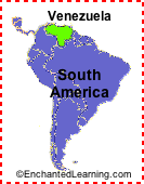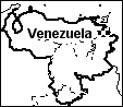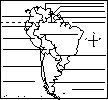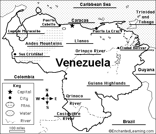
Location: Venezuela (officially called the Bolivarian Republic of Venezuela) is a country in northern South America. Venezuela is bordered by Colombia, Brazil, Guyana, and the Caribbean Sea.
Capital: Caracas is the capital of Venezuela.
Major Cities: Caracas (capital), Maracaibo, Valencia, Barquisimeto, Maracay.
Size: Venezuela covers about 912,050 square kilometers (a bit smaller than the US state of Alaska). Venezuela is the 33rd largest country in the world.
Population: The people of Venezuela are called Venezuelans. Venezuela has the 45th largest population of any country in the world. The population of Venezuela is about 27,635,743 (as of July, 2010).
Government: Venezuela is a republic that is divided into 23 states and a capital district. The national holiday is Independence Day, celebrated on July 5. Venezuela became independent from Spain on July 5, 1811.
Language: The official language is Spanish (official); there are many indigenous dialects.
Education: Girls in Venezuela go to school for an average of 15 years; boys go for an average of 13 years.
Literacy Rate: About 93% (almost all) of the adults in Venezuela can read and write. About 93.3% of the men and 92.7% of the women are literate.
Religion: Nominally Roman Catholic 96%, Protestant 2%, other 2%.
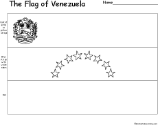
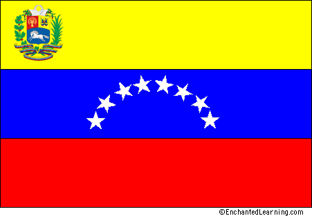 Flag of Venezuela : Venezuela's flag is a yellow, blue, and red horizontal tricolor with eight white stars in a semicircle in the center and the coat of arms on the yellow stripe on the hoist side. The Venezuelan independence leader Francisco de Miranda designed the basic tricolor flag in 1806. Seven stars were added in 1836; they represent the seven provinces that supported Venezuela's independence in 1830. The eighth star, the "Bolívar Star," was added in 2006 to honor Simón Bolívar. The red in the flag represents courage and the blue represents Venezuela's independence from Spain.
The current version of this flag was adopted on March 12, 2006. The flag has a height-to-width ratio of 2:3.
Climate: Venezuela's climate is tropical; it is hot and humid, but more moderate in the highlands.
Major Rivers: The Rio Orinoco flows into Venezuela from Colombia, flows northeastwards across Venezuela into the Caribbean Sea.
Lakes: Lago (Lake) Maracaibo and Lago Valencia.
Terrain/Mountain Ranges: The Andes Mountains and the Maracaibo Lowlands in the northwest; central plains (called llanos); Guiana Highlands in the southeast.
Highest Point: The highest point in Venezuela is Pico Bolivar, which is 5,007 m above sea level; it is located in northwestern Venezuela.
Lowest Point: The lowest point in Venezuela is the Caribbean Sea, at sea level.
Natural Resources: Petroleum, natural gas, iron ore, gold, bauxite, other minerals, hydropower, diamonds.
Major Industries: Petroleum, construction materials, food processing, textiles; iron ore mining, steel, aluminum; motor vehicle assembly.
Agricultural Products: Corn, sorghum, sugarcane, rice, bananas, vegetables, coffee; beef, pork, milk, eggs; fish.
Related Pages:
Enchanted Learning®
Over 35,000 Web Pages
Sample Pages for Prospective Subscribers, or click below
Click to read our Privacy Policy