
|
 Map of Mali |
EnchantedLearning.com Mali |
 Mali's Flag |
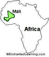 Location: Mali is a dry, inland country in western Africa.
Size: Mali covers an area of 1,240,000 sq km (almost twice the size of the US state of Texas).
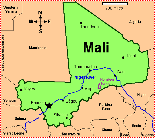
Capital: Bamako is the capital of Mali and the largest city in Mali.
Timbuktu: The ledendary city of Timbuktu (Tombouctou) is located in north central Mali, at the edge of the Sahara Desert. During the middle ages, Timbuktu was an important trade route for salt and other goods, and was an important Islamic center (non-Muslims were banned from the city). Later, when trade routes shifted, Timbuktu was known as the a city in the middle of nowhere.
Major Languages: French, Bambara, Senufu, Fulani, Soninke, and others.
Tribes/Ethnic Groups: Mali is the home of many tribes, including the Mande (which includes the Bambara, Dialonke, Dyula, Malinke, Mandinka, Mende, Soninke, and Susu), Fulani (also called the Peul, nomadic cattle herders), Voltaic, Songhay, Tuareg, Moor, Tuareg (often called the blue people of the desert, because the dye from their clothing rubs off on their skin), and Dogon (farmers).
Flag: The Malian flag is a green, yellow and red vertical tricolor (the green stripe is by the flagpole).
Independence and Democracy: The Sudanese Republic (now called Mali) and Senegal (which together had made up the French Sudan, a French territory) became independent from France in 1960. The Sudanese Republic and Senegal separated within a few months of their independence from France, and the Sudanese Republic was renamed the Republic of Mali.
Mali's constitution was adopted on January 12, 1992. A dictatorship had ruled Mali for years since independence; the first democratic elections were held in 1992. Later, ethnic battles tore Mali apart for years, but a peace agreement was adopted in 1995. Mali is one of the poorest countries in the world.
National Holiday: Mali's Independence Day is celebrated on September 22 (independent from France in 1960).
Climate: Mali generally has a warm (subtropical), dry climate. About half of Mali is in the Sahara Desert (and the desert is expanding each year). Only 2 to 4 percent of Mali is arable (capable of producing farm crops).
Natural Resources: Mali has gold, phosphates, kaolin, salt, limestone, uranium, hydropower (water-powered electricity). Most of the people in Mali (about 70-80 perent) make their living by farming and fishing; about 10 percent of the Malian population is nomadic.
Major Rivers: The major river in Mali is the Niger River; it provides Mali with water, fish, and transportation. The Senegal River separates Mali from Senegal.
Highest Point: The highest point in Mali is Hombori Tondo, which is 1,155 m (3,789 feet) above sea level.
Lowest Point: The lowest point in Mali is the Senegal River (along the southwestern border of Mali), which is 23 m above sea level.
Surrounding Countries: Senegal, Algeria, Niger, Guinea, Burkina Faso, Côte d'Ivoire, and Mauritania.
| Search the Enchanted Learning website for: |