
|
| Our subscribers' grade-level estimate for this page: 3rd - 4th |
 Outline Maps |
EnchantedLearning.com World Geography |
 Flags |
| Africa | Antarctica | Asia | Australia/Oceania | Central America/ Caribbean | Europe | Mideast | North America | South America | USA |
| A | B | C | D | E | F | G | H | I | J | K | L | M | N | O | P | Q | R | S | T | U | V | W | X | Y | Z |
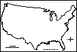 USA (no state borders): Outline Map Printout An outline map of the contiguous USA to print - no state boundaries marked. |
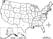
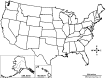 USA (with state borders): Outline Map Printout An outline map of the USA to print - state boundaries marked. |
 USA (with state borders, Contiguous US): Outline Map Printout An outline map of the contiguous USA to print - state boundaries marked. |
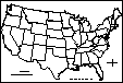
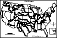
 USA (with state borders and states numbered): Outline Map Printout An outline map of the US states to print - state boundaries marked and the state are numbered (in order of statehood). You can use this map to have students list the 50 US states (answers), the state capitals (answers), or both states and capitals (answers). Or go to a printable page with 50 answer blanks (for your own questions), click here. |
 US Rivers: Outline Map Printout An outline map of the contiguous USA with rivers marked - state boundaries also marked (printable). |
US Rivers Labeled: Outline Map Printout An outline map of the contiguous USA with rivers marked and labeled - state boundaries also marked (printable). |
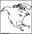 North America: Outline Map Printout An outline map of North America to print. Locate the USA in North America. |
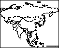
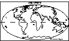 World: Outline Map Printout An outline map of the world to print. See where the USA is located in the world. |
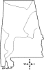 Alabama: Outline Map Printout An outline map of Alabama to print. |
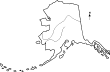 Alaska: Outline Map Printout An outline map of Alaska to print. |
 Arizona: Outline Map Printout An outline map of Arizona to print. |
 Arkansas: Outline Map Printout An outline map of Arkansas to print. |
 California: Outline Map Printout An outline map of California to print. |
 Colorado: Outline Map Printout An outline map of Colorado to print. |
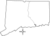 Connecticut: Outline Map Printout An outline map of Connecticut to print. |
Delaware: Outline Map Printout An outline map of Delaware to print. |
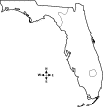 Florida: Outline Map Printout An outline map of Florida to print. |
 Georgia: Outline Map Printout An outline map of Georgia to print. |
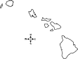 Hawaii: Outline Map Printout An outline map of Hawaii to print. |
 Idaho: Outline Map Printout An outline map of Idaho to print. |
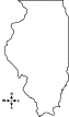 lllinois: Outline Map Printout An outline map of lllinois to print. |
 Indiana: Outline Map Printout An outline map of Indiana to print. |
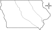 Iowa: Outline Map Printout An outline map of Iowa to print. |
 Kansas: Outline Map Printout An outline map of Kansas to print. |
Kentucky: Outline Map Printout An outline map of Kentucky to print. |
 Louisiana: Outline Map Printout An outline map of Louisiana to print. |
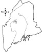 Maine: Outline Map Printout An outline map of Maine to print. |
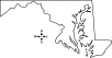 Maryland: Outline Map Printout An outline map of Maryland to print. |
 Massachusetts: Outline Map Printout An outline map of Massachusetts to print. |
 Michigan: Outline Map Printout An outline map of Michigan to print. |
 Minnesota: Outline Map Printout An outline map of Minnesota to print. |
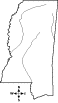 Mississippi: Outline Map Printout An outline map of Mississippi to print. |
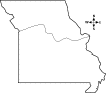 Missouri: Outline Map Printout An outline map of Missouri to print. |
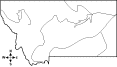 Montana: Outline Map Printout An outline map of Montana to print. |
Nebraska: Outline Map Printout An outline map of Nebraska to print. |
 Nevada: Outline Map Printout An outline map of Nevada to print. |
 New Hampshire: Outline Map Printout An outline map of New Hampshire to print. |
New Jersey: Outline Map Printout An outline map of New Jersey to print. |
 New Mexico: Outline Map Printout An outline map of New Mexico to print. |
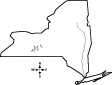 New York: Outline Map Printout An outline map of New York to print. |
North Carolina: Outline Map Printout An outline map of North Carolina state to print. |
 North Dakota: Outline Map Printout An outline map of North Dakota state to print. |
 Ohio: Outline Map Printout An outline map of Ohio to print. |
 Oklahoma: Outline Map Printout An outline map of Oklahoma to print. |
 Oregon: Outline Map Printout An outline map of Oregon state to print. |
 Pennsylvania: Outline Map Printout An outline map of Pennsylvania to print. |
 Puerto Rico: Outline Map Printout An outline map of Puerto Rico to print. |
 Rhode Island: Outline Map Printout An outline map of Rhode Island to print. |
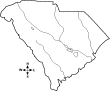 South Carolina: Outline Map Printout An outline map of South Carolina state to print. |
 South Dakota: Outline Map Printout An outline map of South Dakota state to print. |
Tennessee: Outline Map Printout An outline map of Tennessee state to print. |
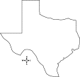 Texas: Outline Map Printout An outline map of Texas to print. |
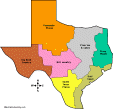 Outline Maps of Texas Regions Print black-and-white or color outline maps of 4 regions of Texas, 7 regions of Texas, or more complex regional maps. |
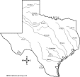 Outline Maps of Major Texas Rivers Print black-and-white outline maps of the major rivers of Texas, labeled and unlabeled. |
 Utah: Outline Map Printout An outline map of Utah state to print. |
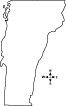 Vermont: Outline Map Printout An outline map of Vermont state to print. |
Virginia: Outline Map Printout An outline map of Virginia to print. |
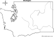 Washington: Outline Map Printout An outline map of Washington state to print. |
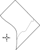 Washington, D.C.: Outline Map Printout A printable outline map of Washington, D.C. |
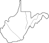 West Virginia: Outline Map Printout An outline map of West Virginia state to print. |
 Wisconsin: Outline Map Printout An outline map of Wisconsin state to print. |
 Wyoming: Outline Map Printout An outline map of Wyoming state to print. |
| EnchantedLearning.com World Geography |
Flags |
| Africa | Antarctica | Asia | Australia/Oceania | Central America/ Caribbean | Europe | Mideast | North America | South America | USA |
| A | B | C | D | E | F | G | H | I | J | K | L | M | N | O | P | Q | R | S | T | U | V | W | X | Y | Z |
Enchanted Learning®
Over 35,000 Web Pages
Sample Pages for Prospective Subscribers, or click below
|
Overview of Site What's New Enchanted Learning Home Monthly Activity Calendar Books to Print Site Index K-3 Crafts K-3 Themes Little Explorers Picture dictionary PreK/K Activities Rebus Rhymes Stories Writing Cloze Activities Essay Topics Newspaper Writing Activities Parts of Speech Fiction The Test of Time
|
Biology Animal Printouts Biology Label Printouts Biomes Birds Butterflies Dinosaurs Food Chain Human Anatomy Mammals Plants Rainforests Sharks Whales Physical Sciences: K-12 Astronomy The Earth Geology Hurricanes Landforms Oceans Tsunami Volcano |
Languages Dutch French German Italian Japanese (Romaji) Portuguese Spanish Swedish Geography/History Explorers Flags Geography Inventors US History Other Topics Art and Artists Calendars College Finder Crafts Graphic Organizers Label Me! Printouts Math Music Word Wheels |
Click to read our Privacy Policy
| Search the Enchanted Learning website for: |
Copyright ©2003-2018 EnchantedLearning.com ------ How to cite a web page