
|
| Our subscribers' grade-level estimate for this page: 4th - 5th |
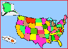 State Map Quiz/Printouts State Population Figures |
EnchantedLearning.com US States (plus Washington D.C.): Extremes and Records Biggest, Smallest, Highest, Lowest, Longest, First, Most Populous, etc. |
 State Flag Printout/Quizzes State Area Figures |
Most Recent State: Hawaii, admitted in 1959
Most Populous State: California, 33,871,648 people (2000 US census)
Least Populous State: Wyoming, 493,782 people (2000 US census)
Biggest City in the USA: New York, New York, with over 7,000,000 people
Birthplaces of the Most Presidents: 8 Presidents born in Virginia (William Henry Harrison, Thomas Jefferson, James Madison, James Monroe, John Tyler, Zachary Taylor, George Washington, and Woodrow Wilson) and 7 Presidents born in Ohio (Ulysses Simpson Grant, Rutherford Birchard Hayes, James Abram Garfield, Benjamin Harrison, William McKinley, William Howard Taft, and Warren Gamaliel Harding).
State with the Most Bordering States: Missouri with 8 bordering states (Arkansas, Illinois, Iowa, Kansas, Kentucky, Nebraska, Oklahoma, Tennessee) and Tennessee with 8 bordering states (Alabama, Arkansas, Georgia, Kentucky, Mississippi, Missouri, North Carolina, Virginia)
Longest State Names (commonly used name): Massachusetts, North Carolina, South Carolina
Longest Official State Name: The State of Rhode Island and Providence Plantations.
Shortest State Names: Iowa, Ohio, Utah
US GEOGRAPHY EXTREMES:
Biggest State (Area): Alaska: 656,425 square miles
Smallest State (Area): Rhode Island, 1,545 square miles
State that is Farthest North: Alaska
State that is Farthest South: Hawaii
State that is Farthest East: Maine (although some of Alaska's Aleutian Islands cross the 180-degree longitude line, and are technically farther east than the other US states).
State that is Farthest West: Alaska
Geographic Center of the Contiguous USA: Smith County, Kansas
Geographic Center of the Entire USA (all 50 states): South Dakota
Highest Point: Mount McKinley, Alaska, 20,300 ft (6,194 m) above sea level
Lowest Point: Death Valley, California, 282 feet (86 m) below sea level [this is the lowest point in the Western Hemisphere]
Longest River: Missouri River (it is a tributary of the Mississippi River and is 2,540 miles long)
River with the Biggest Volume of Water: Mississippi River (2,348 miles (3,778 km) long)
Biggest Lake: Lake Superior with an area of 31,820 square miles (82,414 sq km)
Biggest Island: The Island of Hawaii, with an area of 4,038 square miles (10,459 sq km)
Tallest Waterfall: Ribbon Falls in California, with a height of 1,612 feet (491 m)
Waterfall with the Greatest Volume of Water: Niagara Falls in New York
US WEATHER EXTREMES:
Coldest City: International Falls, Minnesota, with a mean temperature of 36.4 degrees F.
Snowiest City: Blue Canyon, California, with 240.8 inches of snow each year.
Hottest Temperature in the USA: California (134 degrees F at Greenland Ranch on July 10, 1913)
Coldest Temperature in the USA: Alaska (-80 Degrees F on January 23, 1971, at Prospect Creek)
Most Snow in 24 Hours: Colorado, 76 inches (192.5 cm) fell in one day at Silver Lake, Colorado
Most Rain Each Year: Hawaii, 460 inches (1168 cm) fall on Mt. Waialeale, Kauai, Hawaii, each year
Biggest Hailstone: Kansas, the largest hailstone in the US was 44.5 cm (17.5") in circumference. It fell in Coffeyville, Kansas.
Strongest Wind: . Mt. Washington, New Hampshire, where gusts of 231 mph (372 kph) have been recorded
| US State Facts, Map and State Symbols | ||||
|
Alabama
|
Hawaii
|
Massachusetts
|
New Mexico
|
South Dakota
|
| Order and Dates of Statehood | State Population Figures | State Area Figures | State Extremes and Records |
| US Postal Codes | US Postal Codes Matching | Guidelines for Writing a Report on a State | US Geography |
Enchanted Learning®
Over 35,000 Web Pages
Sample Pages for Prospective Subscribers, or click below
|
Overview of Site What's New Enchanted Learning Home Monthly Activity Calendar Books to Print Site Index K-3 Crafts K-3 Themes Little Explorers Picture dictionary PreK/K Activities Rebus Rhymes Stories Writing Cloze Activities Essay Topics Newspaper Writing Activities Parts of Speech Fiction The Test of Time
|
Biology Animal Printouts Biology Label Printouts Biomes Birds Butterflies Dinosaurs Food Chain Human Anatomy Mammals Plants Rainforests Sharks Whales Physical Sciences: K-12 Astronomy The Earth Geology Hurricanes Landforms Oceans Tsunami Volcano |
Languages Dutch French German Italian Japanese (Romaji) Portuguese Spanish Swedish Geography/History Explorers Flags Geography Inventors US History Other Topics Art and Artists Calendars College Finder Crafts Graphic Organizers Label Me! Printouts Math Music Word Wheels |
Click to read our Privacy Policy
| Search the Enchanted Learning website for: |