|
| You might also like: | Whippet Printout | Karakul Sheep Printout | Pronghorn Printout | Old English Sheepdog Printout | Mastiff Printout | Today's featured page: White House |
| Our subscribers' grade-level estimate for this page: 4th - 5th |
 Maryland Map Quiz/Printout Maryland Outline Map Printout |
EnchantedLearning.com Maryland Facts, Map and State Symbols |
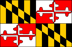
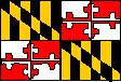 Maryland Flag Printout/Quiz Large Flag Printable |
State Abbreviation - MD
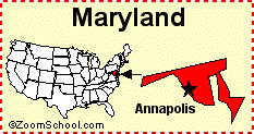
State Capital - Annapolis
Largest City - Baltimore
Area - 12,407 square miles [Maryland is the 42nd biggest state in the USA]
Population - 5,928,814
(as of 2013) [Maryland is the 19th most populous state in the USA]
Name for Residents - Marylanders
Major Industries - farming (corn, soybeans, tobacco, poultry and dairy products), mining (coal), steel products, communications equipment, fishing (crabs and oysters), government services

| State Flag
|
Animal Symbols:
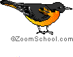
| State Bird | State Reptile
(Malaclemys terrapin) |
State Fish Rockfish (Striped Bass) (Morone saxatilis) |
State Crustacean Maryland Blue Crab (Callinectes sapidus) |
| State Insect Baltimore Checkerspot Butterfly (Euphydryas phaeton) |
State Dinosaur A plant-eating dinosaur known only from its fossilized teeth. Astrodon was found in 1858 by Philip Tyson. |
State Fossil Shell Ecphora gardnerae gardnerae A Miocene gastropod |
State Dog Chesapeake Bay retriever |
Plant Symbols:
| State Flower Black-eyed susan |
State Tree Species White oak (Quercus alba) The Wye oak (a huge, 460-year-old white oak is the official state tree) |
Earth Symbols:
| State Soil Maryland Sassafras (unofficial) |
Miscellaneous Symbols:
| State Beverage
|
State Boat Skipjack A sailing boat used to dredge for oysters on the floor of Chesapeake Bay.. |
State Folk Dance Square dance |
State Sport Jousting |
Related Pages:
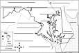
Maryland: Map/Quiz Printout Answer geography questions about Maryland using the map on this quiz. Answers |
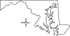 Maryland: Outline Map Printout An outline map of Maryland to print. |
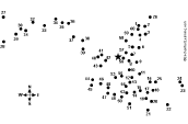 Maryland: US State Dot to Dot Mystery Map Connect the dots to draw the borders of a mystery state of the USA. Then use a globe or atlas to figure out which state you have drawn. You might want to give students clues, such as that it is in the eastern USA, that its capital is Annapolis, or that its name starts with "M." Answer: Maryland. |
 Maryland: Label Me! Printout Label the major features of Maryland. Answers |
Maryland's Flag Printout/Quiz Read about and answer questions on the flag of Maryland. |
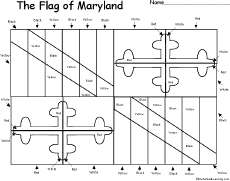 Maryland's Flag: Large Coloring Printable A large black-and-white printable of the flag of Maryland. |
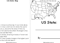
 Your State: Draw and Write Draw a map of the state that you live in (in the USA) and write about it. |
 US State - Find Related Words For a US state, write eight words related to the state, then use each word in a sentence. |
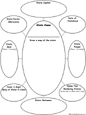 US State Graphic Organizer For one US state, write the name of the state, draw a map of the state, then write the state capital, postal abbreviation, date of statehood, state bird (draw and write), state flower (draw and write), a major body of water in the state, two bordering states, and state nickname. |
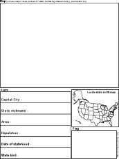 US State Report Graphic Organizer Printout #1 This printout helps the student do a short report on a US state, prompting the student to draw a map of the state, locate it on a US map, draw the state's flag, and write its capital city, state nickname, area, population, date of statehood, and state bird. |
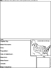 US State Report Graphic Organizer Printout #2 This printout helps the student do a short report on a US state, prompting the student to draw a map of the state, locate it on a US map, draw the state's flag, and write its capital city, state nickname, area, population, date of statehood, state bird, state flower, climate, and major industries. |
 US State Printable Book A short, printable book on a US state. To complete the book, the student must research a US state, draw its map, draw its flag, and answer simple questions about the state. |
 USA Map: Find Your State Find and label your state in the USA, and label other important geography. Answers |
USA Map: Where I Live Write your country, state, and city, and then find and label your state (and a few other geographical features). |
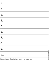 Write Ten Things About Your State A one-page printable worksheet. Write ten things about your state (plus one thing you would like to change). |
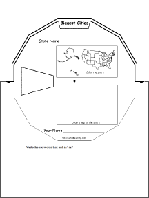 US State Wheel This 2-page print-out makes a wheel about a single US state; the student fills out the information on the wheel. It consists of a base page together with a rear wheel that spins around. After putting the wheel together, the student follows the instructions on the front wheel (coloring in the state on a US map and drawing a small map of the state) and fills out the 12 sections of the wheel with information about one state. When you spin the wheel, facts about the US State appear, including: Biggest Cities, Capital, Flag, Bodies of Water, Postal Abbreviation, State Bird, Population (rank), Area (rank), Residents Called, Bordered by, Major Industries, and Entered Union (order). |
 US State - Find a Related Word for Each Letter For a US state, see if you can think of and write down a word or phrase that is related to that state for each letter of the alphabet. Think of cities, famous people from the state, bodies of water, mountains, landmarks, and other features. Find words for as many letters as you can. |
 The Census A census is an official count of the number of people in a region. The survey is done by a government, usually periodically. This page explains how and why censuses are taken. |
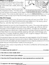 Census: Printable Read-and-Answer Worksheet A printable worksheet on the census, with a short text to read, a map to color, and questions to answer. Or go to the answers. Or go to a pdf file with the worksheet and the answers. |
| US State Facts, Map and State Symbols | ||||
|
Alabama
|
Hawaii
|
Massachusetts
|
New Mexico
|
South Dakota
|
| Order and Dates of Statehood | State Population Figures | State Area Figures | State Extremes and Records |
| US Postal Codes | US Postal Codes Matching | Guidelines for Writing a Report on a State | US Geography |
Enchanted Learning®
Over 35,000 Web Pages
Sample Pages for Prospective Subscribers, or click below
|
Overview of Site What's New Enchanted Learning Home Monthly Activity Calendar Books to Print Site Index K-3 Crafts K-3 Themes Little Explorers Picture dictionary PreK/K Activities Rebus Rhymes Stories Writing Cloze Activities Essay Topics Newspaper Writing Activities Parts of Speech Fiction The Test of Time
|
Biology Animal Printouts Biology Label Printouts Biomes Birds Butterflies Dinosaurs Food Chain Human Anatomy Mammals Plants Rainforests Sharks Whales Physical Sciences: K-12 Astronomy The Earth Geology Hurricanes Landforms Oceans Tsunami Volcano |
Languages Dutch French German Italian Japanese (Romaji) Portuguese Spanish Swedish Geography/History Explorers Flags Geography Inventors US History Other Topics Art and Artists Calendars College Finder Crafts Graphic Organizers Label Me! Printouts Math Music Word Wheels |
Click to read our Privacy Policy
| Search the Enchanted Learning website for: |
Copyright ©2001-2018 EnchantedLearning.com ------ How to cite a web page