
|
| Our subscribers' grade-level estimate for this page: 4th |
 Outline Maps |
EnchantedLearning.com World Geography |
 Flags |
| Africa | Antarctica | Asia | Australia/Oceania | Central America/ Caribbean | Europe | Mideast | North America | South America | USA |
| A | B | C | D | E | F | G | H | I | J | K | L | M | N | O | P | Q | R | S | T | U | V | W | X | Y | Z |
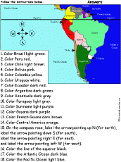 South America: Follow the Instructions Draw and color South America according to simple directions, such as, "Color Peru red." Or go to the answers. |
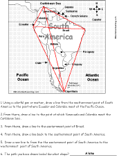 South America: Follow the Instructions #2 Draw lines on the map of South America according to simple directions, such as, "Draw a line back to the easternmost point of Brazil." Or go to the answers. |
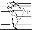
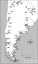
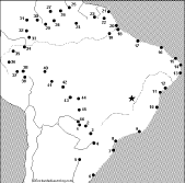
 South America: Map Quiz Printout Take a quiz on the map of South America. Or go to the answers. |
 South American Countries: Label Me! Printout Label the countries of South America. Answers |
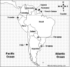
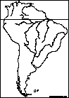
 South America: Outline Map Printout An outline map of South America (with country markings) to print. |
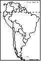
 South America (no country markings): Outline Map Printout An outline map of South America (with no country markings) to print. |
 South American Country Report Graphic Organizer Printout #1 This printout helps the student do a short report on a South American country, prompting the student to draw a map of the country, locate it on a map of South America, draw the country's flag, and write the country's continent, capital city, area, population, name of currency, and language(s). |
 South American Country Report Graphic Organizer Printout #2 This printout helps the student do a short report on a South American country, prompting the student to draw a map of the country, locate it on a map of South America, draw the country's flag, and write the country's continent, capital city, area, population, name of currency, language(s), climate, type of government, and major industries. |
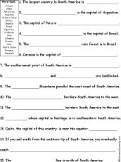 South America Quiz A Worksheet to Print A short, printable worksheet quiz about South America. The short-answer worksheet asks 15 general questions about South America, for example, "The largest country in South America is ______." Select the answers from a word bank. Or go to the answers. |
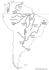
 South American Rivers: Outline Map Printout An outline map of the major rivers of South America to print. |
 South American Rivers Labeled: Outline Map Printout A labeled outline map of the major rivers of South America to print. |
 Explorers of South America Traders, explorers, conquistadors, missionaries, and scientists who explored this continent. |
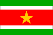 Flags of South America |
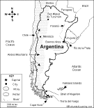
 All About Argentina Information on Argentina, a large country at the southeastern tip of South America. Do worksheets on the map and the flag of Argentina. |
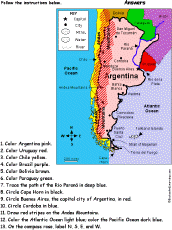 Argentina: Follow the Instructions Color Argentina according to simple directions, such as, "Trace the path of the Rio Paraná in deep blue." Or go to the answers. |
 Argentina: Map Quiz Worksheet A printable quiz on the major geographic features of Argentina. The student reads a map to answer 10 geography questions. Or go to the answers. |
 Argentina's Map: Label Me! Printout Label the map of Argentina. Answers |
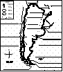
 Argentina: Outline Map Printout An outline map of Argentina to print. Or go to printable activities that require research (using an atlas or other geography reference): a simple map research activity, a medium-level map research activity, or an advanced map research activity. |
 Argentina: Dot to Dot Mystery Map Connect the dots to draw the borders of a mystery country. Then use a globe or atlas to figure out which country you have drawn. You might want to give students clues, such as the continent the country is in (South America), that it is in the Southern Hemisphere, or that its name starts with "A." Answer: Argentina. |
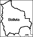 Bolivia: Outline Map Printout An outline map of Bolivia to print. Or go to printable worksheets that require research (using an atlas or other geography reference): a simple map research activity, a medium-level map research activity, or an advanced map research activity. |
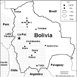 Bolivia: Map Quiz Worksheet A printable quiz on the major geographic features of Bolivia. The student reads a map to answer 10 geography questions. Or go to the answers. |
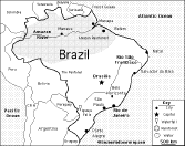
 Brazil Information and activities on Brazil to print. |
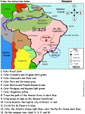 Brazil: Follow the Instructions Color Brazil according to simple directions, such as, "Draw green stripes on the Amazon Rainforest." Or go to the answers. |
 Brazil: Map Quiz Worksheet A printable quiz on the major geographic features of Brazil. The student reads a map to answer 10 geography questions. Or go to the answers. |
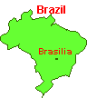
 Brazil: Label Me! Printout Label the map of Brazil. Answers |
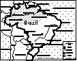
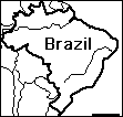 Brazil: Outline Map Printout An outline map of Brazil to print. Or go to printable worksheets that require research (using an atlas or other geography reference): a simple map research activity, a medium-level map research activity, or an advanced map research activity. |
 Brazil: Zoom School Learn about Brazil's flag, animals, map, rainforests, and so on, using a pictorial interface (Grades K-3). |
 Brazil: Dot to Dot Mystery Map Connect the dots to draw the borders of a mystery country. Then use a globe or atlas to figure out which country you have drawn. You might want to give students clues, such as the continent the country is in (South America), that it is in the Southern Hemisphere, or that its name starts with a "B." Answer: Brazil. |
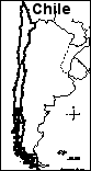 Chile: Outline Map Printout An outline map of Chile to print. Or go to printable activities that require research (using an atlas or other geography reference): a simple map research activity, a medium-level map research activity, or an advanced map research activity. |
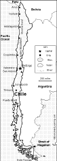 Chile: Map Quiz Worksheet A printable quiz on the major geographic features of Chile. The student reads a map to answer 10 geography questions. Or go to the answers. |
 All About Colombia Information on Colombia, a country in South America. Do worksheets on the map and the flag of Colombia. |
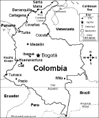 Colombia: Map Quiz Worksheet A printable quiz on the major geographic features of Colombia. The student reads a map to answer 10 geography questions. Or go to the answers. |
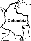 Colombia: Outline Map Printout An outline map of Colombia to print. Or go to printable worksheets that require research (using an atlas or other geography reference): a simple map research activity, a medium-level map research activity, or an advanced map research activity. |
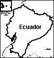 Ecuador: Outline Map Printout An outline map of Ecuador to print. Or go to printable activities that require research (using an atlas or other geography reference): a simple map research activity, a medium-level map research activity, or an advanced map research activity. |
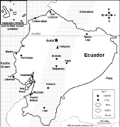 Ecuador: Map Quiz Worksheet A printable quiz on the major geographic features of Ecuador. The student reads a map to answer 10 geography questions. Or go to the answers. |
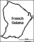 French Guiana: Outline Map Printout An outline map of Guyana to print. |
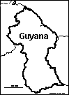 Guyana: Outline Map Printout An outline map of Guyana to print. |
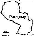 Paraguay: Outline Map Printout An outline map of Paraguay to print. |
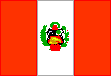 All About Peru Information on Peru, a country in South America. Do worksheets on the map and the flag of Peru. Wednesday, March 30, 2011 |
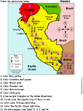 Peru: Follow the Instructions Color Peru according to simple directions, such as, "Color Lake Titicaca dark blue." Or go to the answers. |
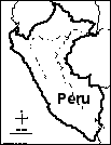 Peru: Outline Map Printout An outline map of Peru to print. Or go to printable activities that require research (using an atlas or other geography reference): a simple map research activity, a medium-level map research activity, or an advanced map research activity. |
 Peru: Dot to Dot Mystery Map Connect the dots to draw the borders of a mystery country. Then use a globe or atlas to figure out which country you have drawn. You might want to give students clues, such as the continent the country is in (South America), that it is in the Southern Hemisphere, or that its name starts with "P." Answer: Peru. |
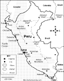 Peru: Map Quiz Worksheet A printable quiz on the major geographic features of Peru. The student reads a map to answer 10 geography questions. Or go to the answers. |
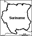 Suriname: Outline Map Printout An outline map of Suriname to print. |
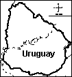 Uruguay: Outline Map Printout An outline map of Uruguay to print. Or go to printable worksheets that require research (using an atlas or other geography reference): a simple map research activity, a medium-level map research activity, or an advanced map research activity. |
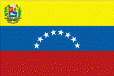 All About Venezuela Information on Venezuela, a country in South America. Do worksheets on the map and the flag of Venezuela. |
 Venezuela Map: Label Me! Printout Label the map of Venezuela. Answers |
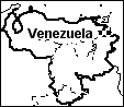 Venezuela: Outline Map Printout An outline map of Venezuela to print. Or go to printable worksheets that require research (using an atlas or other geography reference): a simple map research activity, a medium-level map research activity, or an advanced map research activity. |
South America: Map Quiz Printout Take a quiz on the map of South America. Or go to the answers. |
Little Explorers Picture Dictionary:
-English
-English-French
-English-German
-English-Italian
-English-Japanese
-English-Portuguese
-English-Spanish
Enchanted Learning®
Over 35,000 Web Pages
Sample Pages for Prospective Subscribers, or click below
|
Overview of Site What's New Enchanted Learning Home Monthly Activity Calendar Books to Print Site Index K-3 Crafts K-3 Themes Little Explorers Picture dictionary PreK/K Activities Rebus Rhymes Stories Writing Cloze Activities Essay Topics Newspaper Writing Activities Parts of Speech Fiction The Test of Time
|
Biology Animal Printouts Biology Label Printouts Biomes Birds Butterflies Dinosaurs Food Chain Human Anatomy Mammals Plants Rainforests Sharks Whales Physical Sciences: K-12 Astronomy The Earth Geology Hurricanes Landforms Oceans Tsunami Volcano |
Languages Dutch French German Italian Japanese (Romaji) Portuguese Spanish Swedish Geography/History Explorers Flags Geography Inventors US History Other Topics Art and Artists Calendars College Finder Crafts Graphic Organizers Label Me! Printouts Math Music Word Wheels |
Click to read our Privacy Policy
| Search the Enchanted Learning website for: |
Copyright ©2002-2018 EnchantedLearning.com ------ How to cite a web page