States
Add Filters
Add Filters
Subjects
States
Alabama
(11)
Alaska
(19)
Arizona
(11)
Arkansas
(13)
California
(22)
Colorado
(12)
Connecticut
(10)
Delaware
(16)
Florida
(10)
Georgia
(16)
Hawaii
(18)
Idaho
(20)
Illinois
(13)
Indiana
(9)
Iowa
(12)
Kansas
(15)
Kentucky
(11)
Louisiana
(14)
Maine
(14)
Maryland
(12)
Massachusetts
(10)
Michigan
(14)
Minnesota
(10)
Mississippi
(18)
Missouri
(11)
Montana
(9)
Nebraska
(11)
Nevada
(15)
New Hampshire
(9)
New Jersey
(10)
New Mexico
(9)
New York
(15)
North Carolina
(9)
North Dakota
(9)
Ohio
(10)
Oklahoma
(12)
Oregon
(12)
Pennsylvania
(10)
Rhode Island
(10)
South Carolina
(9)
South Dakota
(10)
Tennessee
(14)
Utah
(15)
Vermont
(11)
Virginia
(22)
Washington
(50)
West Virginia
(9)
Wisconsin
(10)
Wyoming
(13)
Page Types
Activities & Fun
(303)
Crafts
(29)
Printouts
(661)
Quizzes
(260)
Teacher Resources
(25)
Worksheets
(165)
Grade Levels
Work in Progress - Not all pages are categorized yet
Preschool
(0)
Kindergarten
(4)
1st Grade
(58)
2nd Grade
(159)
3rd Grade
(337)
4th Grade
(484)
5th Grade
(260)
6th Grade
(51)
7th Grade and Up
(10)
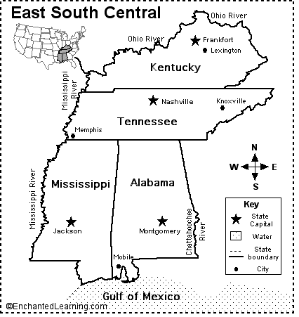
East South Central States Map/Quiz Printout.
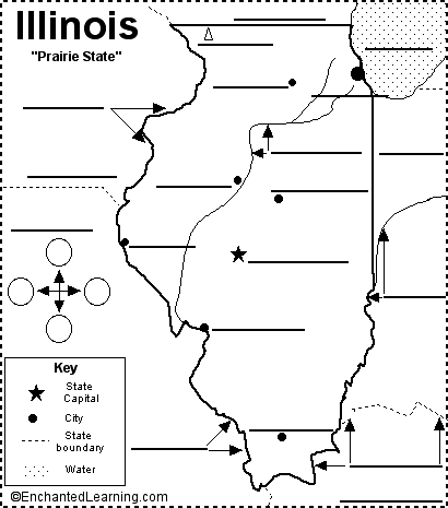
Label Illinois State Map Printout.
Outline Maps of USA - Printouts: A collection of geography pages, printouts, and activities for students.
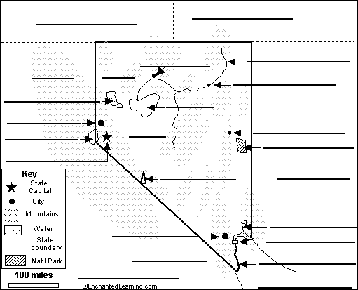
Label Nevada State Map Printout.
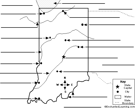
Label Indiana State Map Printout.
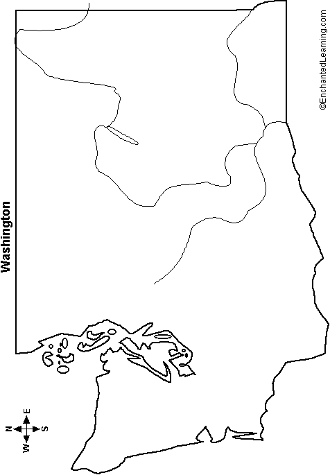
Outline Map Washington State: A collection of geography pages, printouts, and activities for students.
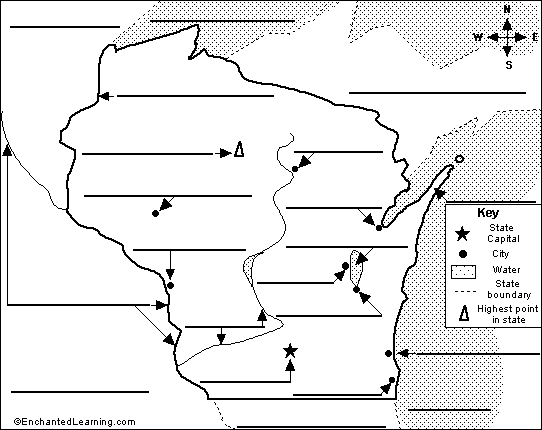
Label Wisconsin State Map Printout.
Table of the Biggest US States - Reading and Understanding Tables, A Printable Worksheet. Use the table about the US States...
Birds as symbols of countries and states. American state birds, US state birds, USA, national birds, and mythological birds.
| Previous Page | Page 9 of 130 | Next Page |