
|
| You might also like: | Outline Map: Nigeria | Nigeria Flag Quiz/Printout | Nigeria's Flag | African Flags Wheel - Bottom: Printable Worksheet | Tunisia | Today's featured page: Asian Animals Coloring/Info Pages |
| Our subscribers' grade-level estimate for this page: 5th - 6th |
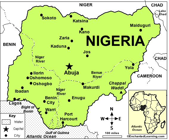
Capital: Abuja is the capital of Nigeria.
Major Cities: Lagos, Kano, Ibadan, Kaduna, Port Harcourt, Benin City, Maiduguri, Zaria, Aba, Jos, Ilorin, Oyo, Enugu, Abeikuta, Abuja (the capital).
Size: Nigeria covers about 923,768 square kilometers (about twice as big as the state of California). Nigeria is the 32nd largest country in the world.
Population: The people of Nigeria are called Nigerians. Nigeria has the 8th largest population of any country in the world (after China, India, USA, Indonesia, Brazil, Pakistan, and Bangladesh). The population of Nigeria is about 152,217,341 (as of July, 2010).
Government: Nigeria is a federal republic that is divided into 36 states and 1 territory. Independence Day (National Day) is celebrated on October 1 (Nigeria became independent from Britain on October 1, 1960).
Language: The official language is English. Other languages include Hausa, Yoruba, Igbo (Ibo), and Fulani.
Education: Girls in Nigeria go to school for an average of 8 years; boys go for an average of 10 years.
Literacy Rate: About 68% (about two-thirds) of the adults in Nigeria can read and write. About 76% of the men and 61% of the women are literate.
Official Religion: Muslim 50%, Christian 40%, indigenous beliefs 10%.
This flag was chosen in a competition held in 1959; the winning entry also had a red sun with rays on it, but the sun and rays were removed by the judges. The flag is twice as wide as it is tall.
Major Rivers: The Niger and Benue Rivers merge in Nigeria and then flow into the Gulf of Guinea.
Terrain/Mountain Ranges: Southern lowlands merge into central hills and plateaus; mountains in the southeast, plains in the north.
Highest Point: The highest point in Nigeria is Chappal Waddi, which is 2,419 m above sea level; it is located in eastern Nigeria near the Cameroon border.
Lowest Point: The lowest point in Nigeria is the Atlantic Ocean, at sea level.
Natural Resources: Natural gas, petroleum, tin, iron ore, coal, limestone, niobium, lead, zinc, arable land.
Major Industries: Crude oil, coal, tin, columbite; rubber products, wood; hides and skins, textiles, cement and other construction materials, food products, footwear, chemicals, fertilizer, printing, ceramics, steel.
Agricultural Products: Cocoa, peanuts, cotton, palm oil, corn, rice, sorghum, millet, cassava (tapioca), yams, rubber; cattle, sheep, goats, pigs; timber; fish.
Nigeria's FlagEnchantedLearning.com
All About Nigeria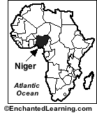
Map/Quiz Printout
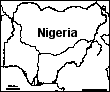
Location: Nigeria (officially called the Federal Republic of Nigeria) is a country in western Africa. Nigeria is bordered by Benin, Niger, Chad, Cameroon and the Gulf of Guinea (part of the Atlantic Ocean).
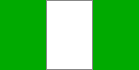
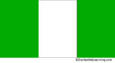 Nigeria's Flag: Nigeria's flag was adopted on October 1, 1960, after Nigeria became independent from Great Britain. The flag consists of three vertical bands of green and white; it is a vertical triband. The green symbolizes the land, and the white symbolizes unity and peace.
Climate: Nigeria is equatorial in the south, tropical in the center, and dry in north.
Related Activities and Printouts:
 Nigeria: Outline Map Printout An outline map of Nigeria to print. |
Nigeria: Map Quiz Worksheets Go to printable worksheets that require geography research (using an atlas or other geography reference): a simple map research activity, a medium-level map research activity, or an advanced map research activity. |
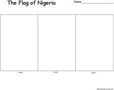 Flag of Nigeria to Color Color a blackline master (printout) of the flag of Nigeria. |
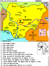 Nigeria: Follow the Instructions Color Nigeria according to simple directions, such as, "Color Pakistan yellow." Or go to the answers. |
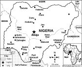 Nigeria: Map Quiz Worksheet A self-contained rintable quiz on the major geographic features of Nigeria. The student reads a map to answer 10 geography questions. Or go to the answers. |
Flag of Nigeria A page on the flag plus a quiz to print. |
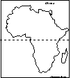 Africa: Outline Map Printout An outline map of Africa to print. |
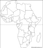 African Countries: Outline Map Printout An outline map of African countries to print. |
 African Countries Printout: Label Me! Label the countries of Africa. Answers |
 Africa: Zoom School Use a pictorial interface to get information on Africa. including maps, quizzes, animals, explorers, and printouts on Africa. |
Reference:
CIA World Factbook
Enchanted Learning®
Over 35,000 Web Pages
Sample Pages for Prospective Subscribers, or click below
|
Overview of Site What's New Enchanted Learning Home Monthly Activity Calendar Books to Print Site Index K-3 Crafts K-3 Themes Little Explorers Picture dictionary PreK/K Activities Rebus Rhymes Stories Writing Cloze Activities Essay Topics Newspaper Writing Activities Parts of Speech Fiction The Test of Time
|
Biology Animal Printouts Biology Label Printouts Biomes Birds Butterflies Dinosaurs Food Chain Human Anatomy Mammals Plants Rainforests Sharks Whales Physical Sciences: K-12 Astronomy The Earth Geology Hurricanes Landforms Oceans Tsunami Volcano |
Languages Dutch French German Italian Japanese (Romaji) Portuguese Spanish Swedish Geography/History Explorers Flags Geography Inventors US History Other Topics Art and Artists Calendars College Finder Crafts Graphic Organizers Label Me! Printouts Math Music Word Wheels |
Click to read our Privacy Policy
| Search the Enchanted Learning website for: |