North America & Printouts & 4th Grade
Page 2 of 605 Filtered Results
Add Filters
Add Filters
Page Types
Printouts
Awards
(0)
Bookmarks
(1)
Books
(88)
Gift Tags
(0)
Graphic Organizers
(101)
Name Tags
(2)
Word Wheels
(4)
Canadian and Alaskan Native Americans Printable Graphic Organizer Worksheet with Map: A graphic organizer to organize...
★
Full access for members only.
Outline Map of Honduras: A collection of geography pages, printouts, and activities for students.
North Dakota State Map/Quiz Printout.
North Carolina State Map/Quiz Printout.
Outline Map Guatemala: A collection of geography pages, printouts, and activities for students.
Outline Map Cuba: A collection of geography pages, printouts, and activities for students.
Canadian and Alaskan Native Americans Printable Graphic Organizer Worksheet with Map: A graphic organizer to organize...
★
Full access for members only.
An outline map of the contiguous USA with rivers marked - state boundaries also marked (printable).
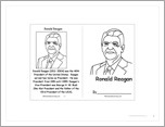
This is a short, printable activity book about Ronald Reagan, the 40th President of the USA, for fluent readers.
★
Full access for members only.
US Map Chart Printout: 5 W's labeled sections around a main oval, labeled, Who, When, What, Where, and Why.
★
Full access for members only.
| Previous Page | Page 2 of 61 | Next Page |

