A page on US rivers with a glossary of river terms. The United States of America has over 250,000 rivers, with a total of about 3,500,000 miles of rivers.
The United States of America has over 250,000 rivers, with a total of about 3,500,000 miles of rivers. The longest river in the USA is the Missouri River (it is a tributary of the Mississippi River and is 2,540 miles long), but the biggest in terms of water volume is the deeper Mississippi River. The longest undammed river in the contiguous USA is the Yellowstone River (it is 692 miles long).
Rivers provide drinking water, irrigation water, transportation, electrical power, drainage, food, and recreation. Rivers also erode land and carry it downstream to the sea. This kind of erosion can even form canyons, like the Grand Canyon, and waterfalls, like Niagara Falls.

Major US Rivers (in order by length)
| River Name | Length | Flows Into |
|---|---|---|
| 1. Missouri | 2,540 miles | Mississippi River |
| 2. Mississippi | 2,340 miles | Gulf of Mexico |
| 3. Yukon | 1,980 miles | Bering Sea |
| 4. Rio Grande | 1,900 miles | Gulf of Mexico |
| 4. St. Lawrence | 1,900 miles | Gulf of St. Lawrence |
| 6. Arkansas | 1,460 miles | Mississippi River |
| 7. Colorado | 1,450 miles | Gulf of California |
| 8. Red | 1,290 miles | Mississippi River |
| 9. Brazos | 1,280 miles | Gulf of Mexico |
| 10. Columbia | 1,240 miles | Pacific Ocean |
| 11. Snake | 1,040 miles | Columbia River |
| 12. Platte | 990 miles | Missouri River |
| 13. Ohio | 981 miles | Mississippi River |
| 14. Pecos | 926 miles | Gulf of Mexico |
| 15. Canadian | 906 miles | Arkansas River |
| 16. Tennessee | 886 miles | Ohio River |
| 17. Colorado | 862 miles | Matagordo Bay |
| 18. North Canadian | 800 miles | Canadian River |
| 19. Mobile | 774 miles | Gulf of Mexico |
| 20. Kansas | 743 miles | Missouri River |
| 21. Kuskokwim | 724 miles | Bering Sea |
| 22. Green | 730 miles | Colorado River |
| 23. James | 710 miles | Missouri River |
| 24. Yellowstone | 692 miles | Missouri River |
| 25. Tanana | 659 miles | Yukon River |
| 26. Gila | 630 miles | Colorado River |
| 27. Milk | 625 miles | Missouri River |
| 28. Quachita | 605 miles | Red River |
Refs
- Encyclopedia Britannica and Kammerer, J.C., May, 1990, Largest Rivers in the United States, US Geological Survey Fact Sheet, Open File Report 87-242.
Note
Measuring the exact length of a river is diffcult, and the length can change over time. Many references cite different lengths for the same river. Averages have been taken in these cases.
Related Pages

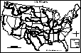
An outline map of the contiguous USA with rivers marked - state boundaries also marked (printable).
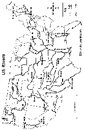
Outline Map of US Rivers Labeled. An outline of US rivers.
Find Your State Label Me! Printout.
Where I Live in the USA Label Me! Printout.
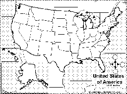
Outline Map of the USA. An outline of the US without state borders.

Outline Map of the Continental US States. An outline of the Continental US with state borders.

Facts, map and state symbols for the 50 US states, with links to related quizzes and printouts.
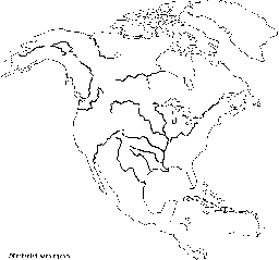
Outline Map Rivers of North America: A collection of geography pages, printouts, and activities for students.
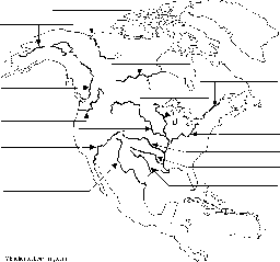
Rivers of North America Label Me! Printout.