
|
| You might also like: | F: GEOGRAPHY | Label the Regions of Italy (Le Regioni Italiane) | J: GEOGRAPHY | Outline Map: the Republic of Ireland | India - Follow the Instructions | Today's featured page: Blue |
| Our subscribers' grade-level estimate for this page: 4th - 5th |
 Outline Maps |
EnchantedLearning.com World Geography |
 Flags |
| Africa | Antarctica | Asia | Australia/Oceania | Central America/ Caribbean | Europe | Mideast | North America | South America | USA |
| A | B | C | D | E | F | G | H | I | J | K | L | M | N | O | P | Q | R | S | T | U | V | W | X | Y | Z |
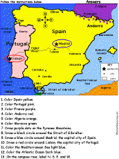 Iberian Peninsula: Spain and Portugal: Follow the Instructions Color Spain and Portugal according to simple directions, such as, "Draw a red circle around Lisbon, the capital city of Portugal." Or go to the answers. |
 Iberian Peninsula: Spain and Portugal Map Quiz Worksheet A printable quiz on the major geographic features of Spain and Portugal. The student reads a map to answer 10 geography questions. Or go to the answers. |
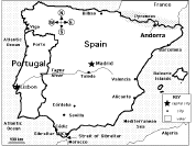
 Iberian Peninsula Label Me! Printout Label the map of Spain and Portugal. Answers |
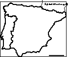 Iberian Peninsula: Outline Map Printout An outline map of Spain and Portugal to print. |
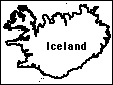 Iceland An outline map of Iceland to print. |
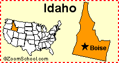 Idaho Idaho is a state in the United States of America. Its capital is Boise. Map, flag, symbols, printouts, and quizzes. |
 Idea Matrix Puzzle: Geography Words In this sorting and classifying activity, the student fills in the blanks (and some categories) in an idea matrix using a word bank. Classify and sort the words by category and word structure. Word bank: Asia, Africa, continent, directions, east, elevation, Europe, gulf, nautical chart, North America, scale, sea, Stars with N, summit, waterfall, west. Or go to the answers. Or go to a pdf of the puzzle and the answers. |
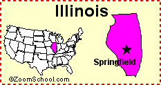 Illinois Illinois is a state in the United States of America. Its capital is Springfield. Map, flag, symbols, printouts, and quizzes. |
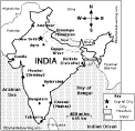
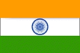 India Information and activities on India to print. |
 India: Map Quiz Worksheet A printable quiz on the major geographic features of India. The student reads a map to answer 10 geography questions. Or go to the answers. |
 India: Label Me! Printout Label the map of India. Answers |
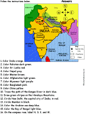 India: Follow the Instructions Color India according to simple directions, such as, "Trace the path of the Ganges River in blue." Or go to the answers. |
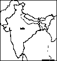 India: Outline Map Printout An outline map of India to print. Or go to printable activities that require research (using an atlas or other geography reference): a simple map research activity, a medium-level map research activity, or an advanced map research activity. |
 India: Dot to Dot Mystery Map Connect the dots to draw the borders of a mystery country. Then use a globe or atlas to figure out which country you have drawn. You might want to give students clues, such as the continent the country is in (Asia), that it is in the Northern Hemisphere, or that its name starts with "I." Answer: India. |
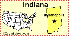 Indiana Indiana is a state in the United States of America. Its capital is Indianapolis. Map, flag, symbols, printouts, and quizzes. |
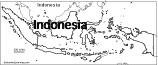
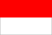 All About Indonesia Information on Indonesia, a country in Southeastern Asia . Do worksheets on the map and the flag of Indonesia. |
 Indonesia: Outline Map Printout An outline map of Indonesia to print. |
Indonesia: Map Quiz Worksheets Go to printable worksheets that require geography research (using an atlas or other geography reference): a simple map research activity, a medium-level map research activity, or an advanced map research activity. |
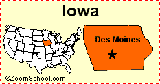 Iowa Iowa is a state in the United States of America. Its capital is Des Moines. Map, flag, symbols, printouts, and quizzes. |
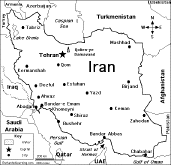
 All About Iran Information on Iran, a country in northern Africa. Do worksheets on the map and the flag of Iran. |
 Iran: Map Quiz Worksheet A printable quiz on the major geographic features of Iran. The student reads a map to answer 10 geography questions. Or go to the answers. |
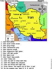 Iran: Follow the Instructions Color Iran according to simple directions, such as, "Color Iran yellow." Or go to the answers. |
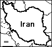 Iran: Outline Map Printout An outline map of Iran to print. Or go to printable activities that require research (using an atlas or other geography reference): a simple map research activity, a medium-level map research activity, or an advanced map research activity. |
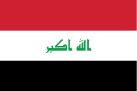 All About Iraq Information on Iraq, a country in Southwestern Asia (in the Middle East). Do worksheets on the map and the flag of Iraq. |
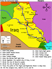 Iraq: Follow the Instructions Color Iraq according to simple directions, such as, "Trace the paths of the Tigris and Euphrates Rivers in deep blue." Or go to the answers. |
 Iraq: Map Quiz Worksheet A printable quiz on the major geographic features of Iraq. The student reads a map to answer 10 geography questions. Or go to the answers. |
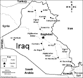
 Iraq: Outline Map Printout An outline map of Iraq to print. Or go to printable activities that require research (using an atlas or other geography reference): a simple map research activity, a medium-level map research activity, or an advanced map research activity. |
 Ireland Read about Ireland, take a geography quiz, and do a map activity. |
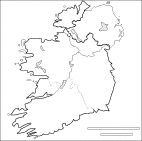 Ireland: Outline Map Printout An outline map of the Republic of Ireland to print. Or go to printable worksheets that require research (using an atlas or other geography reference): a simple map research activity, a medium-level map research activity, or an advanced map research activity. |
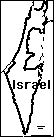 Israel: Outline Map Printout An outline map of Israel to print. Or go to printable activities that require research (using an atlas or other geography reference): a simple map research activity, a medium-level map research activity, or an advanced map research activity. |
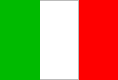 Italian Theme Page Information, quizzes, and printouts on the Italian language and Italy. |
 Italy Maps, a quiz, and information on Italy. |
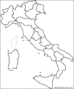
 Italy: Outline Map Printout An outline map of Italy to print. Or go to printable worksheets that require research (using an atlas or other geography reference): a simple map research activity, a medium-level map research activity, or an advanced map research activity. |
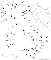 Italy: Dot to Dot Mystery Map Connect the dots to draw the borders of a mystery country. Then use a globe or atlas to figure out which country you have drawn. You might want to give students clues, such as the continent the country is in (Europe), or that its name starts with an "I." Answer: Italy. |
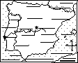
 Regions of Italy: Outline Map Printout An outline map of the regions of Italy to print. |
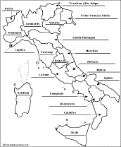 Italian Regions: Label Me! Map Printout Label the regions of Italy. Answers |
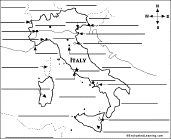 Italy: Label Me! Printout A printable map of Italy to label - label the major cities, bodies of water, major peaks, and bordering countries. Or go to the answers. |
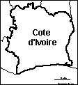 Ivory Coast: Outline Map Printout An outline map of Cote d'Ivoire to print. |
| EnchantedLearning.com World Geography |
Flags |
| Africa | Antarctica | Asia | Australia/Oceania | Central America/ Caribbean | Europe | Mideast | North America | South America | USA |
| A | B | C | D | E | F | G | H | I | J | K | L | M | N | O | P | Q | R | S | T | U | V | W | X | Y | Z |
Enchanted Learning®
Over 35,000 Web Pages
Sample Pages for Prospective Subscribers, or click below
|
Overview of Site What's New Enchanted Learning Home Monthly Activity Calendar Books to Print Site Index K-3 Crafts K-3 Themes Little Explorers Picture dictionary PreK/K Activities Rebus Rhymes Stories Writing Cloze Activities Essay Topics Newspaper Writing Activities Parts of Speech Fiction The Test of Time
|
Biology Animal Printouts Biology Label Printouts Biomes Birds Butterflies Dinosaurs Food Chain Human Anatomy Mammals Plants Rainforests Sharks Whales Physical Sciences: K-12 Astronomy The Earth Geology Hurricanes Landforms Oceans Tsunami Volcano |
Languages Dutch French German Italian Japanese (Romaji) Portuguese Spanish Swedish Geography/History Explorers Flags Geography Inventors US History Other Topics Art and Artists Calendars College Finder Crafts Graphic Organizers Label Me! Printouts Math Music Word Wheels |
Click to read our Privacy Policy
| Search the Enchanted Learning website for: |
Copyright ©2002-2018 EnchantedLearning.com ------ How to cite a web page