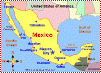
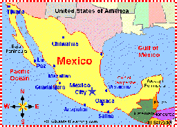
Mexico is a large, Spanish-speaking country in southern North America. In Spanish, the name of this country is Estados Unidos Mexicanos (the United Mexican States). It is the fourth-largest country in the Western Hemisphere.
 Mexico is a large, Spanish-speaking country in southern North America. In Spanish, the name of this country is Estados Unidos Mexicanos (the United Mexican States). It is the fourth-largest country in the Western Hemisphere.
Through the centuries, Mexico has been inhabited by Teotihuacans, Toltecs, Aztecs, and Spanish conquistadors. Mexico achieved independence from Spain early in the 19th century.
- Capital
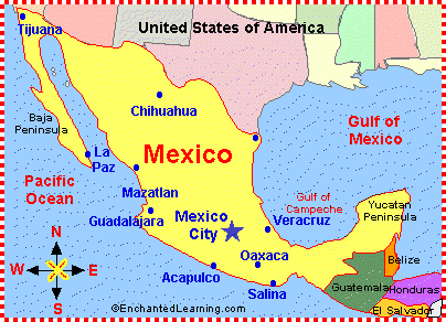
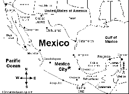
- Mexico’s capital is Mexico City; its original name was Tenochtitlan. It is one of the largest cities in the world, with a population of about 20 million people. Mexico City was founded around AD 1325.
- Location
- Mexico is located between the United States of America (at the north) and Guatemala and Belize (at the south). At Mexico’s west is the Pacific Ocean; at the east is the Gulf of Mexico and the Caribbean Sea.
- Climate
- Mexico’s climate varies from hot deserts, forests, tropical rainforests, and some chapparal (along the northwestern coastline).
- Area
- Mexico covers almost 2 million square kilometers of land. It has 9,330 kilometers of ocean coastline.
- States
- Mexico is divided into 32 states: Aguas Calientes, Baja California, Baja California Sur, Campeche, Chiapas, Chihuahua, Coahuila, Colima, Durango, Estado de México, Guanajuato, Guerrero, Hidalgo, Jalisco, Michoacán, Morelos, Nayarit, Nuevo León, Oaxaca, Puebla, Querétaro, Quintana Roo, San Luis Potosí, Sinaloa, Sonora, Tabasco, Tamaulipas, Tlaxcala, Vera Cruz, Yucatán, Zacatecas, plus a Federal District (Mexico City).

Zoom School is an on-line elementary-school classroom. Subject links include geography, science activities, stories, history, crafts, animals, art, time information, and games, and relate to the theme - Mexico.
Mexican Flag Printout.

The Mexican flag - large, color version.
Flag of Mexico: Color the flag of Mexico.
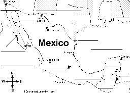
Mexico map/quiz printout. Look at the map and answer 10 geography questions about Mexico.
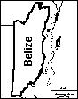
Label the Map of Mexico Printout.

Label Mexican States Map Printout.
Outline Map Mexico: A collection of geography pages, printouts, and activities for students.
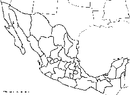
Outline Map of Mexican States: A collection of geography pages, printouts, and activities for students.
Mexico Zoom School is an on-line elementary-school classroom. Subject links include geography, science activities, stories, history, crafts, animals, art, time information, and games, and other subjects that relate to Mexico.
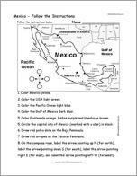
Color this printout about Mexico according to simple directions, such as, “Color the Pacific Ocean light blue”.
Central America and the Caribbean: A collection of geography pages, printouts, and activities for students.
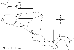
Label Central America Printout.
Outline Map North America: A collection of geography pages, printouts, and activities for students.
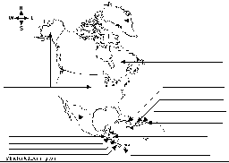
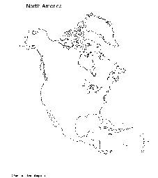
Label North America Printout.
Mexican Independence.
Use the word bank to fill in the blanks in this Mexican Independence cloze activity. This is a printable worksheet.
Spanish Language Activities

Mexican Crafts for kids. Kindergarten, preschool, and elementary school crafts. Make wonderful, simple Mexican crafts with things found around the house.
Find all the words in this Cinco de Mayo wordsearch puzzle, then use the extra letters to read a secret message. This printout is for young students.

Mexican Dinosaur Fossils. See which dinosaur fossils have been found in Mexico.