Alabama Info
Alabama was the 22nd state in the USA; it became a state on December 14, 1819.
State Abbreviation - AL
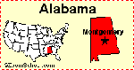
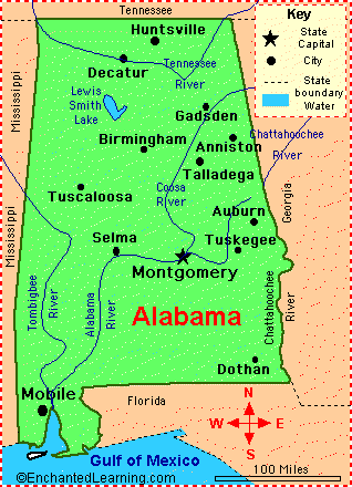
State Capital - Montgomery
Largest City - Birmingham
Area - 52,423 square miles [Alabama is the 30th biggest state in the USA]
Population - 5,157,699 (as of 2024) – Alabama is the 24th most populous state in the USA
Name for Residents - Alabamans
Major Industries - agriculture (cotton, corn, peanuts, soybeans, poultry, and livestock), hydroelectric power, mining (coal, limestone, iron ore), steel-making
Major Rivers - Tombigbee River, Alabama River, Tennessee River, Chattahoochee River
Major Lakes - Guntersville Lake, Wilson Lake, Martin Lake, West Point Lake, Lewis Smith Lake
Highest Point - Cheaha Mountain - 2407 feet, (734 m) above sea level
Number of Counties - 67
Bordering States - Florida, Georgia, Mississippi, Tennessee
Bordering Body of Water - Gulf of Mexico
Origin of the Name Alabama - Alabama means “tribal town” in the language of the local Creek Indians
State Nickname - Heart of Dixie, “Yellowhammer State”
State Motto - “Audemus jura nostra defendere” - We Dare Defend Our Rights
State Song - Alabama
Dinosaur Fossils Found in Alabama - Lophorhothon, Nodosaurus
Alabama State Symbols and Emblems
- State Flag
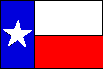
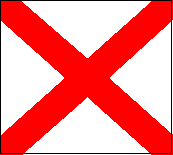 The official state flag of Alabama is called the “crimson cross of St. Andrew’s,” a red cross on a white background. This flag was adopted in 1895, and was patterned from the Confederate Battle Flag. This flag can be any type of rectangle (even a square) but the crimson bars must be six inches wide.
Animal Symbols
| State Bird - Yellowhammer | State Saltwater Fish - (Fighting) Tarpon |
| State Game Bird - Wild Turkey (Meleagris gallopavo)  |
State Freshwater Fish - Largemouth bass |
| State Horse - Racking horse | State Amphibian - Red Hills salamander |
| State Insect - Monarch butterfly (Danaus plexippus)  |
State Shell - Caphella junonia johnstoneae |
State Butterfly and State Mascot - Eastern Tiger Swallowtail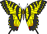 |
State Fossil - Basilosaurus cetoides An extinct whale |
Plant Symbols
| State Flower - Camellia (Camellia japonica ) | State Tree - Southern longleaf pine (Pinus palustris) |
| State Wildflower - Oak-leaf hydrangea | State Nut - Pecan |
Earth Symbols
| State Rock - Marble | State Mineral - Hematite (Red iron ore) |
| State Gemstone - Star Blue Quartz | State Soil - Bama soil series |
Miscellaneous Symbols
| State Dance - Folk dance | State Quilt - Pine burr quilt |
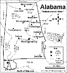
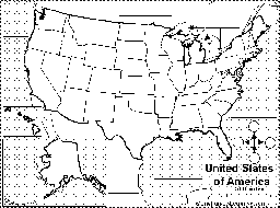
Alabama State Map/Quiz Printout.
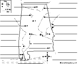
Label Alabama State Map Printout.
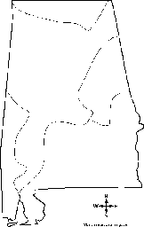
Outline Map Alabama, USA: A collection of geography pages, printouts, and activities for students.
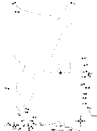
Dot to Dot Mystery Map. Connect the dots to draw the borders of a mystery US state. Then use a globe or atlas to figure out which state you have drawn. Answer: This is a map of Alabama.
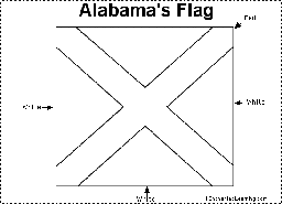
Alabama Flag Printout.

Flag of Alabama: Color the flag of Alabama.
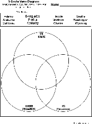
US State/US President/3-Syllables Venn diagram: A printout on classifying words using a Venn diagram. Words: Adams, Alabama, California, Everglades, Florida, Kentucky, Lincoln, Madison, Obama, Seattle, Washington, Wyoming.

Draw and Write. Draw a map of the state you live in and write about that state. You can write facts or information about the state, what you like about the state, how long you have lived there, or anything else about that state.
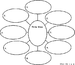
US State Find Eight Related Words. For a US state, write eight words related to the state, then use each word in a sentence - for early readers.
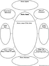
On this ‘US State Graphic Organizer’, write the name of a US state, draw a map, and answer questions about it.
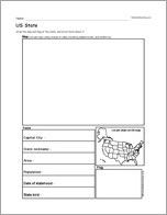
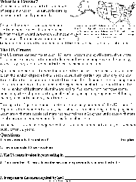
US State Report Diagram Printout: This chart is used to write a short US state report, including a hand-drawn map and flag, capital city, area, population, etc.

US State Report Diagram Printout: Thiss chart is used to write a short US state report, including a hand-drawn map and flag, capital city, area, population, etc.
US State, A Printable Book. Print out US State early reader book.
Find Your State Label Me! Printout.
Where I Live in the USA Label Me! Printout.
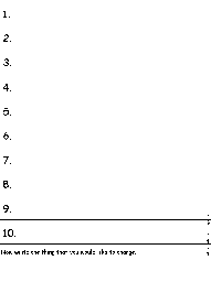
Write Ten Things About Your State - A short answer printable worksheet. Write ten things about your state (plus one thing you would like to change).

US State Wheel : This 2-page print-out makes a wheel about a single US state; the student fills out the information on the wheel. It consists of a base page together with a wheel that spins around. After putting the wheel together, the student follows the instructions on the front wheel and fills out the 12 sections of the wheel with information about the state. When you spin the wheel, facts about the US State appear, including: Biggest Cities, Capital, Flag, Bodies of Water, Postal Abbreviation, State Bird, Population (rank), Area (rank), Residents Called, Bordered by, Major Industries, and Entered Union (order).
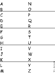
A US State-Find a Related Word for Each Letter: Write a word or phrase for each letter of the alphabet that is related to a US state. Think of cities, famous people from the state, bodies of water, mountains, landmarks, and other features. Find words for as many letters as you can.
A collection of geography pages, printouts, and activities for students - all about the census.
Census Read and Answer Worksheet Page to Print Read and Answer Worksheet
US State Facts, Map and State Symbols
Other Links
| Order and Dates of Statehood | State Extremes and Records | Guidelines for Writing a Report on a State |
| State Population Figures | US Postal Codes | US Geography |
| State Area Figures | US Postal Codes Matching |