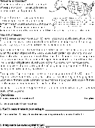
Arizona Info
Arizona was the 48th state in the USA; it became a state on February 14, 1912.
 State Abbreviation - AZ
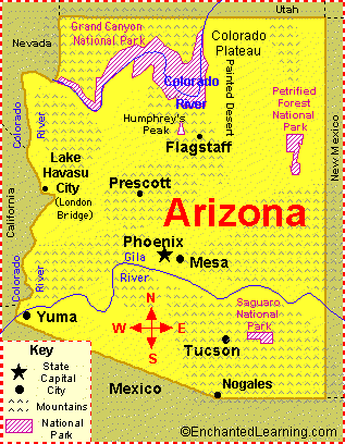
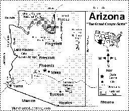
State Capital - Phoenix
Largest City - Phoenix
Area - 114,006 square miles [Arizona is the 6th biggest state in the USA]
Population - 7,582,384 (as of 2024) – Arizona is the 14th most populous state in the USA
Name for Residents - Arizonans
Major Industries - mining (copper, molybdenum, gold, and silver), manufacturing, and tourism
Major Rivers - Colorado River, Little Colorado River, Gila River, Bill Williams River
Major Lakes - Lake Mead, Lake Havasu, Lake Mohave, Theodore Roosevelt Lake, San Carlos Lake, Lake Powell
Highest Point - Humphreys Peak - 12,633 feet (3,581 m) above sea level
Number of Counties - 15
Bordering States - California, Colorado, Nevada, New Mexico, Utah
Bordering Country - Mexico
Origin of the Name Arizona - The word Arizona comes from one of the following (its origin is not certain): the Aztec Indian word “arizuma,” that means “silver-bearing,” from the Tohono O’odham Indian word “Aleh-zone” which means “small spring,” or the Pima Indian word “Ali shonak” which also means “small spring.”
State Nickname - Grand Canyon State
State Motto - “Ditat Deus,” God Enriches
State Song - Arizona March Song
Dinosaur Fossils Found in Arizona - Ammosaurus, Anchisaurus, Anomoepus, Chindesaurus, Coelophysis, Dilophosaurus, Eubrontes, Massospondylus, Navahopus, Revueltosaurus, Rioarribasaurus, Scutellosaurus, Segisaurus, Sonorasaurus, Syntarsus
Arizona State Symbols and Emblems
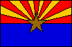
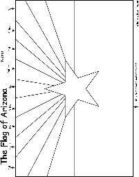
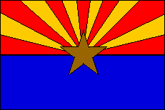 State Flag - The official state flag of Arizona was officially adopted on February 17, 1917. It was designed by Colonel Charles W. Harris (adjutant general and chief administrative officer of Arizona) and was first sewn by Nan D. Hayden.
The 13 yellow and red rays represent both the Sun’s rays and the original 13 colonies of the United States of America. The colors red and yellow are used because they were the colors of the flag of the Spanish conquistadors led by Francisco Vasquez de Coronado, who entered Arizona in 1540 (looking for the legendary Seven Cities of Cibola). The copper-colored star in the middle represents copper mining, since Arizona produces more copper than any other state in the USA.
Arizona was the 48th state in the USA; it was admitted in 1912 (it had been part of Mexico before the Mexican War).
Animal Symbols
| State Bird - Cactus wren | State Amphibian - Arizona Tree Frog |
| State Mammal - Ringtail | State Fish - Arizona trout |
| State Reptile - Arizona Ridgenose Rattlesnake | State Insect - Two-tailed Swallowtail (Papilio multicaudatus) |
Plant Symbols
| State Flower - Saguaro Cactus Blossom | State Tree - Palo Verde |
Earth Symbols
| State Fossil - Petrified wood | State Soil - Arizona Casa - Grande (unofficial). |
| State Gemstone - Turquoise |
Miscellaneous Symbols
| State Neckwear - The bolo tie | State Colors - Blue and old gold |
Related Pages
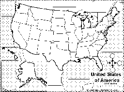
Arizona State Map/Quiz Printout.
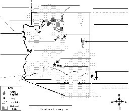
Label Arizona State Map Printout.

Outline Map Arizona, USA: A collection of geography pages, printouts, and activities for students.
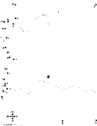
Dot to Dot Mystery Map. Connect the dots to draw the borders of a mystery US state. Then use a globe or atlas to figure out which state you have drawn. Answer: This is a map of Arizona.
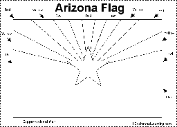
Arizona Flag Printout.
Flag of Arizona: Color the flag of Arizona.

Draw and Write. Draw a map of the state you live in and write about that state. You can write facts or information about the state, what you like about the state, how long you have lived there, or anything else about that state.
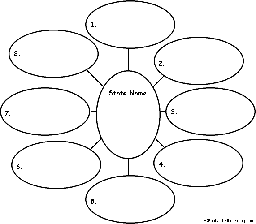
US State Find Eight Related Words. For a US state, write eight words related to the state, then use each word in a sentence - for early readers.
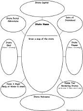
On this ‘US State Graphic Organizer’, write the name of a US state, draw a map, and answer questions about it.
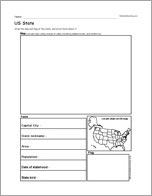
US State Report Diagram Printout: This chart is used to write a short US state report, including a hand-drawn map and flag, capital city, area, population, etc.

US State Report Diagram Printout: Thiss chart is used to write a short US state report, including a hand-drawn map and flag, capital city, area, population, etc.
US State, A Printable Book. Print out US State early reader book.
Find Your State Label Me! Printout.
Where I Live in the USA Label Me! Printout.
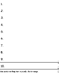
Write Ten Things About Your State - A short answer printable worksheet. Write ten things about your state (plus one thing you would like to change).

US State Wheel : This 2-page print-out makes a wheel about a single US state; the student fills out the information on the wheel. It consists of a base page together with a wheel that spins around. After putting the wheel together, the student follows the instructions on the front wheel and fills out the 12 sections of the wheel with information about the state. When you spin the wheel, facts about the US State appear, including: Biggest Cities, Capital, Flag, Bodies of Water, Postal Abbreviation, State Bird, Population (rank), Area (rank), Residents Called, Bordered by, Major Industries, and Entered Union (order).
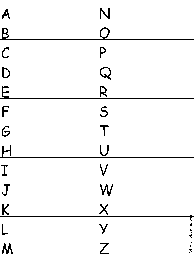
A US State-Find a Related Word for Each Letter: Write a word or phrase for each letter of the alphabet that is related to a US state. Think of cities, famous people from the state, bodies of water, mountains, landmarks, and other features. Find words for as many letters as you can.
A collection of geography pages, printouts, and activities for students - all about the census.
Census Read and Answer Worksheet Page to Print Read and Answer Worksheet
US State Facts, Map and State Symbols
Other Links
| Order and Dates of Statehood | State Extremes and Records | Guidelines for Writing a Report on a State |
| State Population Figures | US Postal Codes | US Geography |
| State Area Figures | US Postal Codes Matching |